
Route Identity
Yellowstone Grand Loop & Grand Teton Ultimate National Park Scenic Road Trip
USA — Wyoming / Montana / Idaho
Overview Layer
Overview
The Yellowstone Grand Loop & Grand Teton Scenic Drive is one of the world's greatest national park road trips. Combining the complete Grand Loop Road in Yellowstone National Park with the spectacular landscapes of Grand Teton National Park, the route features geysers, hot springs, waterfalls, alpine lakes, wildlife, and some of North America's most recognizable mountain scenery. It is the definitive driving experience for exploring the heart of the Rocky Mountains.
Weather
High-elevation continental climate with warm summers, cold snowy winters, and rapidly changing mountain weather. Conditions vary significantly with altitude and can shift quickly throughout the day.
Seasonal Driving Conditions
Spring brings active wildlife, rushing waterfalls, and gradually opening mountain roads as snow retreats from higher elevations.
- active wildlife emerging after winter
- powerful waterfalls fed by snowmelt
Summer offers fully accessible park roads, warm daytime temperatures, and the most reliable driving conditions throughout both national parks.
- fully open scenic roads across both parks
- clear access to geysers, lakes, and mountain viewpoints
Autumn features colorful forests, cooler temperatures, and increased wildlife activity before the onset of winter.
- golden aspen forests and crisp mountain air
- excellent opportunities to observe elk and bison
Winter brings heavy snowfall, seasonal road closures, and limited vehicle access outside designated winter routes.
- snow-covered geothermal landscapes
- limited road access with specialized winter transportation
Road conditions
Well-maintained paved park roads with frequent curves, moderate elevation changes, and seasonal closures due to snow. Expect reduced speeds, wildlife crossings, and occasional traffic delays near major attractions.
Driving difficulty explained
Medium difficulty due to mountain elevations, frequent wildlife crossings, changing weather, and seasonal traffic within the national parks.
Route Snapshot Layer
Route Snapshot
This is a scenic driving route in Wyoming / Montana / Idaho, USA.
The route features moderate driving conditions.
It is classified as Hard and is best suited for general road trip travelers.
Points of Interest
Attractions along the route
- Midway Geyser Basin — 112 m from route (122.2 km from start)
- Red Spouter — 16 m from route (125.8 km from start)
- King Geyser viewing point — 135 m from route (307.7 km from start)
Scenic viewpoints
- Norris Geyser Basin Overlook — 89 m from route (163.0 km from start)
- Washburn Hotsprings Overlook — 76 m from route (245.9 km from start)
- Lehardy rapids — 25 m from route (270.9 km from start)
Actual Driving Track (GPX-data)
Download GPXGPS Data Layer
Measured Driving Route
This route is analyzed directly from GPX track data. It features a total distance of 385.3 km, with an elevation gain of 3380 m.
Route Structure
| Type | Distance (km) | Elevation Gain (m) | Avg Gradient (%) |
|---|---|---|---|
| flat | 296.84 km | 1668 m | 0% |
| climb | 43.04 km | 1662 m | 3.9% |
| descent | 45.38 km | 50 m | -3.5% |
About this route
The Yellowstone Grand Loop & Grand Teton Ultimate National Park Scenic Road Trip is one of the most scenic driving experiences in USA. Located in Wyoming / Montana / Idaho, this route offers a unique combination of landscapes, road conditions and natural highlights.
Stretching over 385.3 km, this drive takes approximately 8 hours.
This route is especially popular among travelers looking for road trips.
Travel Experience
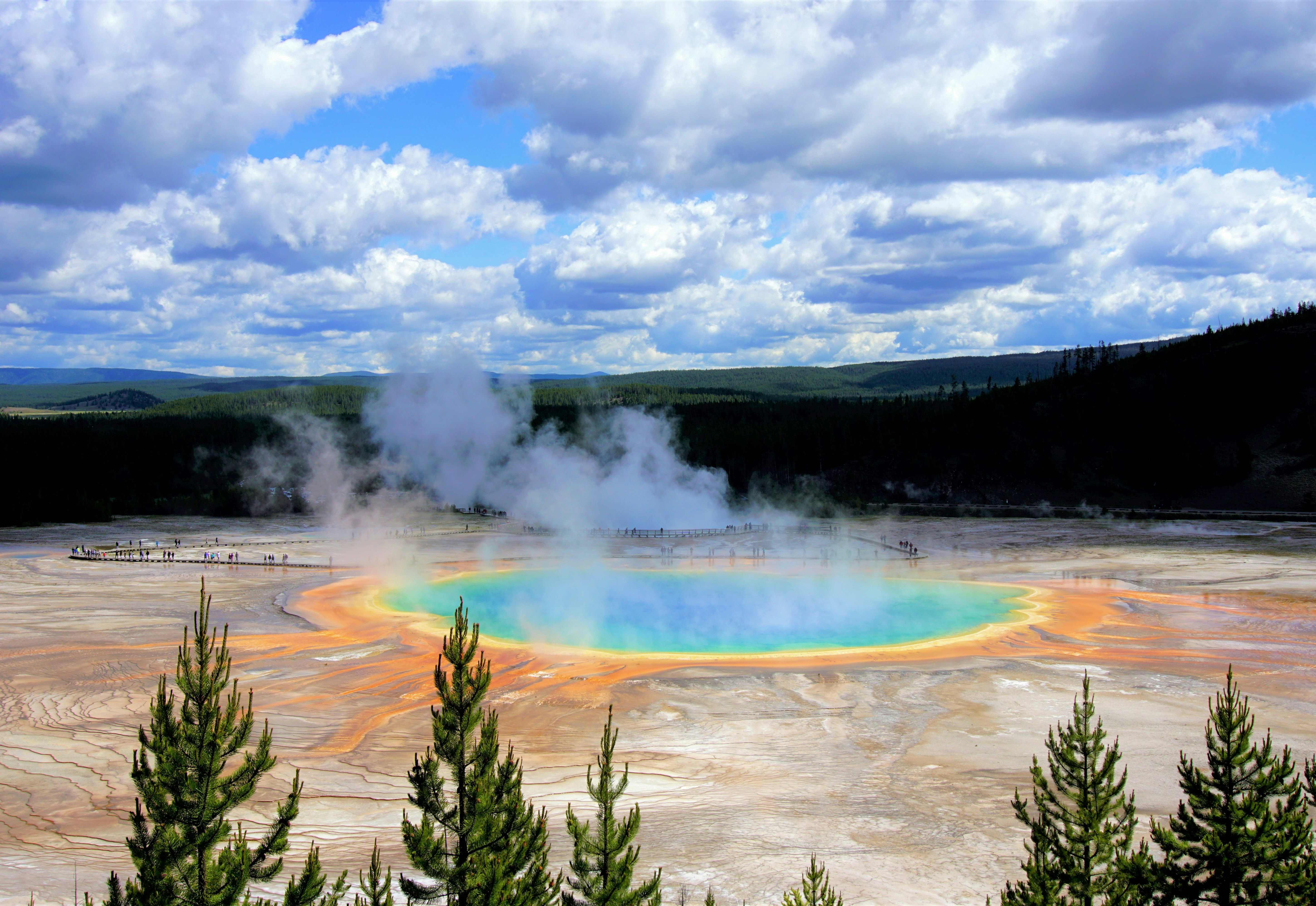
The day starts with Yellowstone's geothermal landscape, where steam rises from the ground long before you reach the famous geyser basins. Every few kilometers the scenery changes completely.
Driving through the park means constantly slowing down—not only for viewpoints but often for bison crossing the road or grazing just a few meters from passing cars.
As the route leaves Yellowstone and heads south, forests gradually give way to open valleys before the sharp skyline of the Teton Range suddenly dominates the horizon.
Several lakes reflect the mountains almost perfectly on calm days, making it difficult to decide whether to keep driving or spend another hour at the shoreline.
By the end of the loop, what stands out most is the incredible diversity packed into a single journey—from volcanic geothermal features and abundant wildlife to glacial lakes and some of the most dramatic peaks in the American Rockies.
Best time to visit
The best time to explore the Yellowstone Grand Loop & Grand Teton Ultimate National Park Scenic Road Trip is typically during spring and summer months, when weather conditions are stable and visibility is high. However, autumn offers fewer crowds and more dramatic scenery.
Travel tips
- Start early to avoid congestion at major geothermal areas
- Allow extra time for wildlife-related traffic delays
- Check seasonal road opening dates before traveling
- Carry warm clothing, as temperatures can change rapidly with elevation
Why visit
- Scenic landscapes unique to Wyoming / Montana / Idaho
- Popular road trip destination in USA
- Great for photography
- Varied terrain and driving conditions
Driving Interpretation Layer
What this route means
How long is this route?
The route is approximately 385.3 km long, with an elevation gain of 3380 m.
How difficult is the drive?
This route is classified as Hard, with a maximum gradient of 6.0%.
What kind of terrain does it have?
This is a high alpine mountain route with significant elevation changes and exposed terrain.
What makes this route unique?
The route combines elevation variation (3380 m total gain) with changing landscapes shaped by natural geography and road conditions.
What type of driver is this route best suited for?
This route is best suited for experienced drivers comfortable with steep gradients, narrow mountain roads, and changing weather conditions.
Discovery Layer
More routes in USA
About USA →
Blue Ridge Parkway Scenic Mountain Drive
Scenic mountain drive through the Appalachian Highlands.

Pacific Coast Highway Coastal Scenic Drive
Iconic coastal drive along California's Pacific coastline.
Utah National Parks Scenic Loop Drive
Arches, canyons and desert landscapes.
Dalton Highway Arctic Wilderness Drive
One of the most remote roads in North America.
Going-to-the-Sun Road Glacier Scenic Drive
High mountain road crossing Glacier National Park.
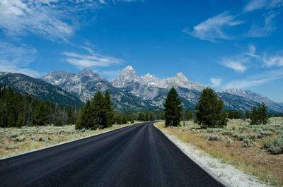
Beartooth Highway Alpine Scenic Drive
High alpine road with dramatic switchbacks.
More similar scenic routes
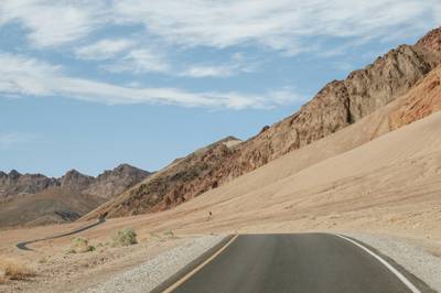
Death Valley Scenic Drive
Extreme desert drive through salt flats, dunes and vast volcanic landscapes in Death Valley National Park
Blue Ridge Parkway Scenic Mountain Drive
Scenic mountain drive through the Appalachian Highlands.
Pacific Coast Highway Coastal Scenic Drive
Iconic coastal drive along California's Pacific coastline.
Utah National Parks Scenic Loop Drive
Arches, canyons and desert landscapes.
Going-to-the-Sun Road Glacier Scenic Drive
High mountain road crossing Glacier National Park.
Beartooth Highway Alpine Scenic Drive
High alpine road with dramatic switchbacks.