
Route Identity
Yungas Death Road Mountain Pass Drive
Bolivia — Yungas
Overview Layer
Overview
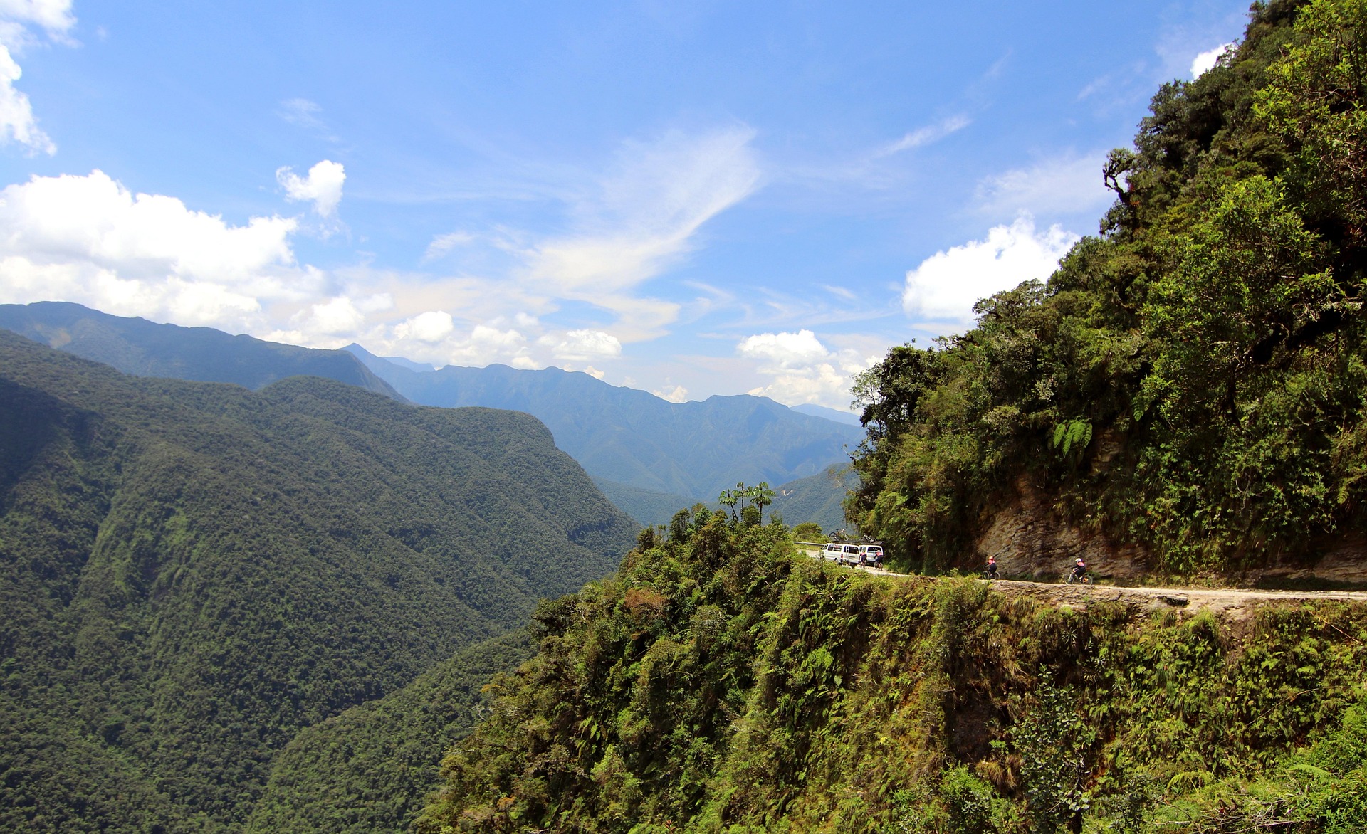
Yungas Road in Bolivia, often referred to as the 'Death Road', is one of the most dramatic and historically notorious mountain routes in the world. Connecting La Paz with the Yungas region, it descends from high Andean altitudes into lush subtropical valleys, following narrow cliffside tracks with extreme elevation changes and breathtaking views. Today it is mainly used for guided adventure trips and remains an iconic route in South America.
Weather
Subtropical mountain climate with high humidity and significant rainfall variability contributing to unstable slope conditions.
Seasonal Driving Conditions
Wet conditions with increased landslide risk and reduced traction.
- wet road surfaces
- increased landslide probability
Rainy season with high precipitation and hazardous driving conditions.
- heavy rainfall
- low traction conditions
Transition period with gradually improving stability and reduced rainfall.
- gradual drying of slopes
- improving road stability
Drier conditions with improved visibility and reduced landslide frequency.
- reduced rainfall
- better visibility conditions
Road conditions
Narrow mountain road with steep drop-offs, limited barriers, and high exposure to landslides and erosion.
Driving difficulty explained
Very high difficulty due to narrow road geometry, elevation, and environmental hazards.
Route Snapshot Layer
Route Snapshot
This is a scenic driving route in Yungas, Bolivia.
The route features moderate driving conditions.
It is classified as Extreme and is best suited for general road trip travelers.
Points of Interest
Scenic viewpoints
- Mirador Chuspipata — 3 m from route (25.4 km from start)
- Mirador Balconsillo — 8 m from route (26.5 km from start)
- San Juan — 12 m from route (35.7 km from start)
- Sacramento — 9 m from route (39.1 km from start)
- Mirador — 3 m from route (59.9 km from start)
Actual Driving Track (GPX-data)
Download GPXGPS Data Layer
Measured Driving Route
This route is analyzed directly from GPX track data. It features a total distance of 60.3 km, with an elevation gain of 5636 m.
Route Structure
| Type | Distance (km) | Elevation Gain (m) | Avg Gradient (%) |
|---|---|---|---|
| descent | 38.43 km | 2439 m | -6.1% |
| climb | 17.79 km | 2977 m | 11.5% |
| flat | 4.06 km | 220 m | 0% |
About this route
The Yungas Death Road Mountain Pass Drive is one of the most scenic driving experiences in Bolivia. Located in Yungas, this route offers a unique combination of landscapes, road conditions and natural highlights.
Stretching over 60.3 km, this drive takes approximately 2 hours.
This route is especially popular among travelers looking for road trips.
Travel Experience
The first part of the descent felt unreal because the air and landscape changed so quickly. One moment we were above the clouds, and the next we were dropping into green valleys carved into the mountains.
At a narrow section we had to stop completely because another vehicle was coming from the opposite direction. There was barely enough space for both, and nobody was in a hurry to move.
There were long stretches where the road clung to the edge of the cliff and the drop below felt almost continuous. We didn’t really talk much, just stayed focused and quiet.
We stopped briefly at a viewpoint where you could see both the higher Andes behind us and the jungle ahead. It was one of those places where the scale is hard to process all at once.
By the end of the Yungas Road descent, the biggest impression wasn’t a single view or stop, but the constant feeling of transition from cold, dry altitude to humid, green valleys in a matter of hours.
Best time to visit
The best time to explore the Yungas Death Road Mountain Pass Drive is typically during spring and summer months, when weather conditions are stable and visibility is high. However, autumn offers fewer crowds and more dramatic scenery.
Travel tips
- Use appropriate vehicle clearance for narrow sections
- Avoid travel during heavy rainfall periods
- Maintain low speed on exposed cliff sections
Why visit
- Scenic landscapes unique to Yungas
- Popular road trip destination in Bolivia
- Great for photography
- Varied terrain and driving conditions
Driving Interpretation Layer
What this route means
How long is this route?
The route is approximately 60.3 km long, with an elevation gain of 5636 m.
How difficult is the drive?
This route is classified as Extreme, with a maximum gradient of 27.7%.
What kind of terrain does it have?
This is a high alpine mountain route with significant elevation changes and exposed terrain.
What makes this route unique?
The route combines elevation variation (5636 m total gain) with changing landscapes shaped by natural geography and road conditions.
What type of driver is this route best suited for?
This route is best suited for experienced drivers comfortable with steep gradients, narrow mountain roads, and changing weather conditions.
Discovery Layer
More routes in Bolivia
About Bolivia →
More similar scenic routes

Route des Grandes Alpes Alpine Scenic Road Trip
High alpine route crossing multiple mountain passes.

Icefields Parkway Rocky Mountain Scenic Drive
One of the most scenic drives in the Canadian Rockies.

Blue Ridge Parkway Scenic Mountain Drive
Scenic mountain drive through the Appalachian Highlands.
Drakensberg Sani Pass Scenic Scenic Mountain Drive (Sani Pass → Lesotho entry)
Mountain drive along dramatic escarpments.
Great Alpine Scenic Mountain Drive
Mountain road crossing Australian Alps.
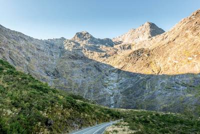
Milford Road Alpine Scenic Drive
Road to Milford Sound with dramatic alpine scenery.