
Route Identity
Theth to Valbona Alpine Mountain Pass Drive
Albania — Northern Alps
Overview Layer
Overview
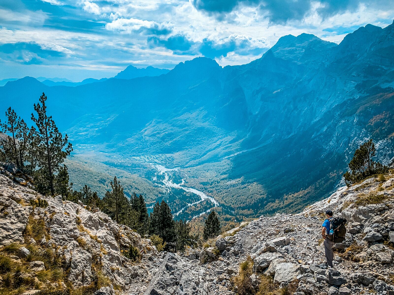
The Theth to Valbona mountain route is one of the most dramatic drives in Albania. It cuts through the Albanian Alps, with steep valleys, remote villages, and rugged high-altitude landscapes far from the coastal tourist routes.
Weather
Alpine continental climate with strong winter snowfall, short summers, and rapid weather changes in mountainous terrain.
Seasonal Driving Conditions
Snowmelt period with partial inaccessibility of high mountain pass sections.
- snowmelt runoff affecting road surface stability
- partial accessibility of high sections
Primary open season with fully accessible mountain trails and roads.
- full accessibility period
- dry gravel and dirt road conditions
Cooling temperatures with increasing precipitation and early snowfall at altitude.
- early frost in higher elevations
- increasing precipitation
Snow accumulation leading to closure of mountain pass roads.
- snow-covered and closed sections
- inaccessible mountain pass
Road conditions
Unpaved mountain pass road with steep gradients, gravel sections, and seasonal closures due to snow.
Driving difficulty explained
High difficulty due to unpaved mountain road, steep elevation, and seasonal closure.
Route Snapshot Layer
Route Snapshot
This is a scenic driving route in Northern Alps, Albania.
The route features moderate driving conditions.
It is classified as Hard and is best suited for general road trip travelers.
Points of Interest
Scenic viewpoints
- Panorama Balcony — 50 m from route (13.6 km from start)
Cafés and stops
- Kafe — 8 m from route (25.2 km from start)
Interesting stops
- Wild camp — 605 m from route (10.1 km from start)
- Wild camp — 167 m from route (25.2 km from start)
- Small wild camp — 334 m from route (25.2 km from start)
- Wild Camping Spot for a 2P tent — 356 m from route (33.8 km from start)
Interesting stops
- GuestHouse VITA — 402 m from route (29.6 km from start)
- 4stinet — 544 m from route (35.0 km from start)
Actual Driving Track (GPX-data)
Download GPXGPS Data Layer
Measured Driving Route
This route is analyzed directly from GPX track data. It features a total distance of 38.0 km, with an elevation gain of 1433 m.
Route Structure
| Type | Distance (km) | Elevation Gain (m) | Avg Gradient (%) |
|---|---|---|---|
| climb | 18.65 km | 1320 m | 6.7% |
| descent | 19.34 km | 113 m | -6.4% |
About this route
The Theth to Valbona Alpine Mountain Pass Drive is one of the most scenic driving experiences in Albania. Located in Northern Alps, this route offers a unique combination of landscapes, road conditions and natural highlights.
Stretching over 38.0 km, this drive takes approximately 1 hours.
This route is especially popular among travelers looking for road trips.
Travel Experience
Leaving Theth, the road starts off deceptively calm, just a narrow track winding between stone houses and steep green slopes. It doesn’t feel like anything special at first, until the valley starts closing in around you.
After a while the road gets rougher and you start paying more attention to every turn. There are sections where you slow down just because the drop next to you feels a bit too close, even if the surface is technically fine.
At some point there’s basically no signal, no traffic, and no real sense of distance anymore. You just keep going because there’s nowhere else to go except forward through the mountains.
The highest sections feel strangely quiet, even when the engine is running. You get out for a minute and it’s just wind, rocks, and distant peaks without any signs of civilization.
The descent toward Valbona feels like a completely different world. The valley opens up slowly, and you start seeing more movement again — a few houses, some farmland, and life returning after hours of emptiness.
Best time to visit
The best time to explore the Theth to Valbona Alpine Mountain Pass Drive is typically during spring and summer months, when weather conditions are stable and visibility is high. However, autumn offers fewer crowds and more dramatic scenery.
Travel tips
- Verify road opening status before travel
- Expect limited infrastructure in mountain areas
- Prepare for gravel and uneven surfaces
Why visit
- Scenic landscapes unique to Northern Alps
- Popular road trip destination in Albania
- Great for photography
- Varied terrain and driving conditions
Driving Interpretation Layer
What this route means
How long is this route?
The route is approximately 38.0 km long, with an elevation gain of 1433 m.
How difficult is the drive?
This route is classified as Hard, with a maximum gradient of 10.6%.
What kind of terrain does it have?
This route features hilly terrain with several steep driving sections.
What makes this route unique?
The route combines elevation variation (1433 m total gain) with changing landscapes shaped by natural geography and road conditions.
What type of driver is this route best suited for?
This route is best suited for experienced drivers comfortable with steep gradients, narrow mountain roads, and changing weather conditions.
Discovery Layer
More routes in Albania
About Albania →
More similar scenic routes

Route des Grandes Alpes Alpine Scenic Road Trip
High alpine route crossing multiple mountain passes.
Great Alpine Scenic Mountain Drive
Mountain road crossing Australian Alps.
Tatra Mountains Scenic Drive
Alpine landscapes and mountain villages.
High Tatras Alpine Scenic Drive
Alpine peaks and mountain lakes.
Vršič Pass Alpine Scenic Drive
Historic alpine pass with tight hairpins and dramatic Julian Alps scenery
Japan Alps Scenic Drive – Epic Nagano Loop Through Mountains, Valleys & Historic Towns
Long circular alpine road trip through Japan Alps, connecting mountain passes, valleys, lakes and cultural regions