
Route Identity
Madeira Island Scenic Mountain Drive
Portugal — Madeira
Overview Layer
Overview
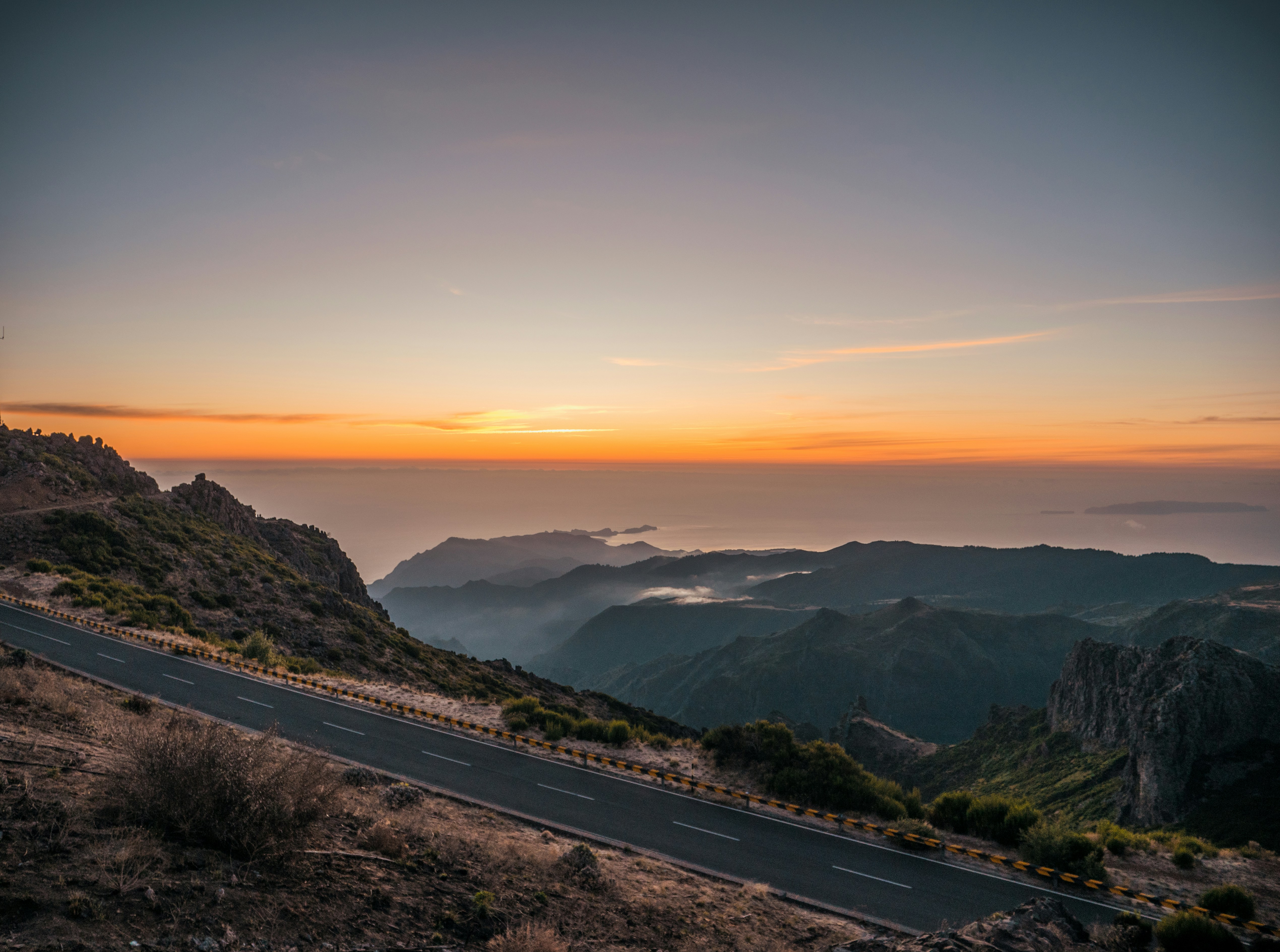
The Madeira Island Scenic Road is one of the most spectacular driving routes in Portugal, combining volcanic mountains, dramatic Atlantic cliffs, lush forests, and coastal villages. Madeira’s winding roads connect high mountain viewpoints with oceanfront towns, offering constant changes in elevation and scenery. The route is a classic island road trip for travelers seeking nature, coastal landscapes, and panoramic viewpoints across the Atlantic Ocean.
Weather
Subtropical oceanic island climate with mild temperatures year-round, strong microclimate variation, and frequent rainfall in high elevations.
Seasonal Driving Conditions
Mild subtropical conditions with moderate rainfall and lush vegetation growth in mountainous areas.
- moderate rainfall supporting vegetation growth
- variable visibility in mountain zones
Warm and relatively dry conditions with stable weather in coastal and mid-altitude roads.
- stable road conditions
- dry coastal and mid-altitude routes
Increasing rainfall with higher humidity and occasional storm systems.
- increasing rainfall frequency
- reduced visibility in highlands
Mild but wetter conditions with frequent rainfall in mountainous terrain.
- wet road surfaces
- occasional rockfall in steep sections
Road conditions
Mountain island road network with tunnels, steep gradients, switchbacks, and occasional rockfall risk after heavy rain.
Driving difficulty explained
Moderate to high difficulty due to steep gradients, tunnels, and rapid microclimate changes.
Route Snapshot Layer
Route Snapshot
This is a scenic driving route in Madeira, Portugal.
The route features moderate driving conditions.
It is classified as Extreme and is best suited for general road trip travelers.
Points of Interest
Scenic viewpoints
- Pedreira — 43 m from route (20.9 km from start)
- Serrado — 13 m from route (28.9 km from start)
- São Cristovão — 6 m from route (47.9 km from start)
- Vigia — 99 m from route (57.5 km from start)
- Ilhéus da Ribeira da Janela — 13 m from route (70.5 km from start)
Attractions along the route
- Casas de Colmo — 71 m from route (29.4 km from start)
- Baloiço da Ribeira da Janela — 22 m from route (74.3 km from start)
Actual Driving Track (GPX-data)
Download GPXGPS Data Layer
Measured Driving Route
This route is analyzed directly from GPX track data. It features a total distance of 139.4 km, with an elevation gain of 3778 m.
Route Structure
| Type | Distance (km) | Elevation Gain (m) | Avg Gradient (%) |
|---|---|---|---|
| flat | 55.91 km | 763 m | 0.1% |
| climb | 44.62 km | 2840 m | 6.2% |
| descent | 38.86 km | 174 m | -6.8% |
About this route
The Madeira Island Scenic Mountain Drive is one of the most scenic driving experiences in Portugal. Located in Madeira, this route offers a unique combination of landscapes, road conditions and natural highlights.
Stretching over 139.4 km, this drive takes approximately 3 hours.
This route is especially popular among travelers looking for road trips.
Travel Experience
What surprised us most was how often the road seemed to switch directions. One moment we were looking out over the ocean, and twenty minutes later we were deep in the mountains surrounded by clouds.
At one viewpoint there were only a handful of cars, but everyone seemed to stay longer than planned. The cliffs looked much steeper in person than they did in any photo we had seen before.
There were sections where tunnels appeared one after another, breaking up the drive into short pieces. Every time we came back into daylight, the landscape looked slightly different.
We stopped in a small coastal village for lunch and ended up watching waves crash against the harbor wall for a while. Nobody was really paying attention to the time anymore.
By the end of the Madeira Island Scenic Road, it felt like we had driven across several different islands rather than one. The constant shifts between ocean views, forests, cliffs, and mountain roads made the day feel much longer than it actually was.
Best time to visit
The best time to explore the Madeira Island Scenic Mountain Drive is typically during spring and summer months, when weather conditions are stable and visibility is high. However, autumn offers fewer crowds and more dramatic scenery.
Travel tips
- Check weather by elevation before driving
- Watch for rockfall after heavy rain
- Use caution on steep switchback roads
Why visit
- Scenic landscapes unique to Madeira
- Popular road trip destination in Portugal
- Great for photography
- Varied terrain and driving conditions
Driving Interpretation Layer
What this route means
How long is this route?
The route is approximately 139.4 km long, with an elevation gain of 3778 m.
How difficult is the drive?
This route is classified as Extreme, with a maximum gradient of 12.6%.
What kind of terrain does it have?
This route features hilly terrain with several steep driving sections.
What makes this route unique?
The route combines elevation variation (3778 m total gain) with changing landscapes shaped by natural geography and road conditions.
What type of driver is this route best suited for?
This route is best suited for experienced drivers comfortable with steep gradients, narrow mountain roads, and changing weather conditions.
Discovery Layer
More routes in Portugal
About Portugal →
More similar scenic routes
Corsica Mountain Scenic Loop Drive
Dramatic mountain roads across Corsica.

Route des Grandes Alpes Alpine Scenic Road Trip
High alpine route crossing multiple mountain passes.

Icefields Parkway Rocky Mountain Scenic Drive
One of the most scenic drives in the Canadian Rockies.

Blue Ridge Parkway Scenic Mountain Drive
Scenic mountain drive through the Appalachian Highlands.
Drakensberg Sani Pass Scenic Scenic Mountain Drive (Sani Pass → Lesotho entry)
Mountain drive along dramatic escarpments.
Great Alpine Scenic Mountain Drive
Mountain road crossing Australian Alps.