
Route Identity
Ukrainian Carpathians Scenic Mountain Drive
Ukraine — Carpathians
Overview Layer
Overview
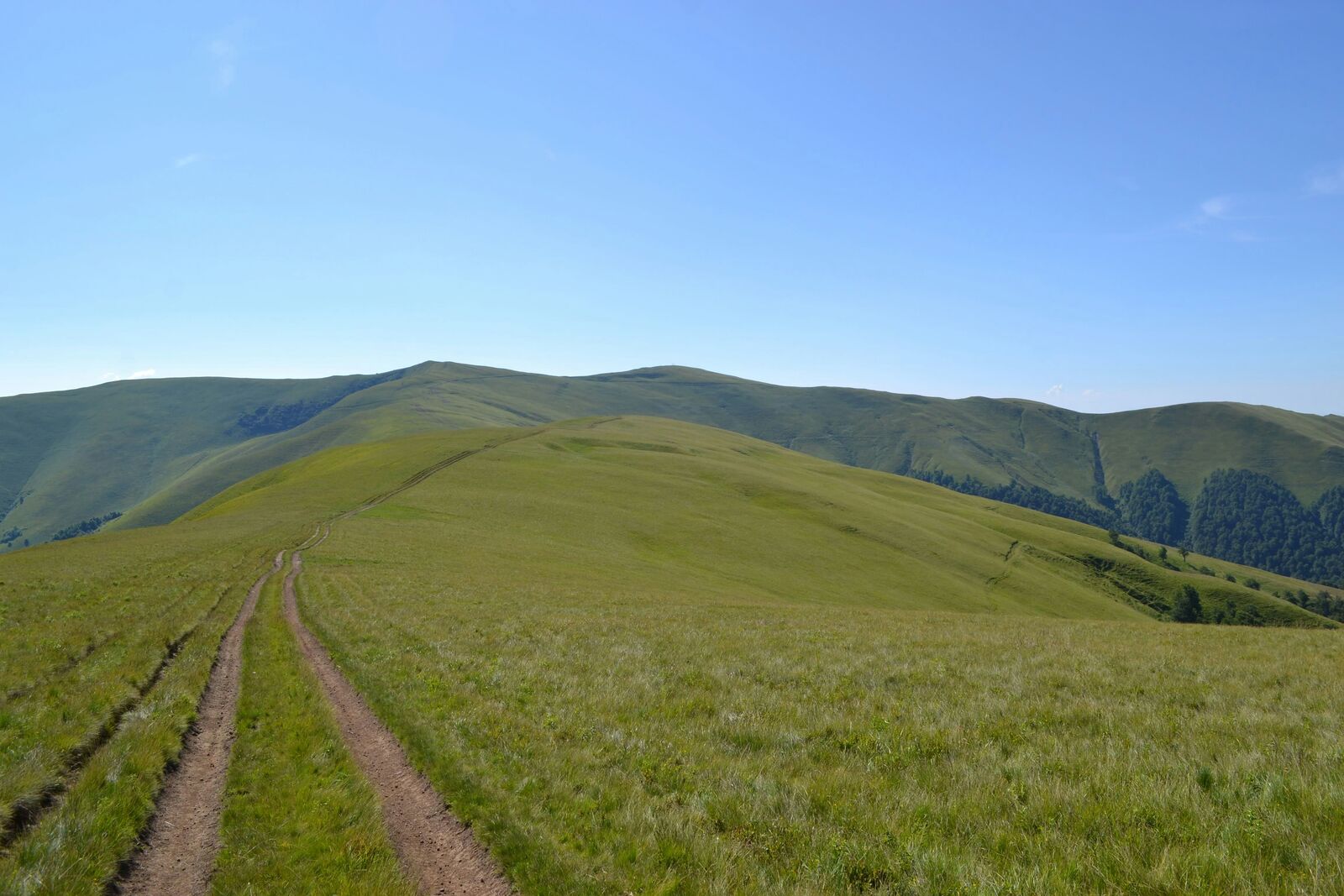
The Ukrainian Carpathians Drive passes through rolling green mountains, traditional villages, and winding forest roads in western Ukraine. It is a long scenic route defined by continuous elevation changes and layered rural landscapes.
Weather
Continental mountain climate with cold winters, moderate summers, and significant seasonal precipitation variation.
Seasonal Driving Conditions
Cool mountain conditions with snowmelt, wet roads, and variable access in higher elevations.
- snowmelt runoff in valleys
- wet forest road surfaces
Mild and stable conditions with best access to forest and mountain routes.
- stable driving conditions
- clear mountain access
Cooling temperatures with frequent fog and wet forest roads.
- frequent valley fog
- wet and slippery roads
Snow, ice, and reduced accessibility in mountain regions.
- snow-covered routes
- reduced traction in forest zones
Road conditions
Mountain and forest roads with winding sections, variable pavement quality, and winter snow and ice impact.
Driving difficulty explained
Moderate to high difficulty due to winding mountain roads and seasonal snow.
Route Snapshot Layer
Route Snapshot
This is a scenic driving route in Carpathians, Ukraine.
The route features moderate driving conditions.
It is classified as Moderate and is best suited for general road trip travelers.
Points of Interest
Attractions along the route
- i love bukovel — 43 m from route (0.8 km from start)
- Я люблю Буковель — 166 m from route (4.5 km from start)
- Знак "Яблуницький перевал" — 86 m from route (13.4 km from start)
Scenic viewpoints
- Труфанець — 19 m from route (30.9 km from start)
Places to eat
- GIRAFA — 45 m from route (3.4 km from start)
- Lucky Bull — 14 m from route (4.0 km from start)
- Саланг — 42 m from route (54.7 km from start)
Cafés and stops
- Фурт Coffee — 13 m from route (153.6 km from start)
Interesting stops
- Lecho — 34 m from route (154.3 km from start)
Actual Driving Track (GPX-data)
Download GPXGPS Data Layer
Measured Driving Route
This route is analyzed directly from GPX track data. It features a total distance of 258.8 km, with an elevation gain of 978 m.
Route Structure
| Type | Distance (km) | Elevation Gain (m) | Avg Gradient (%) |
|---|---|---|---|
| flat | 240.99 km | 615 m | -0.3% |
| descent | 11.4 km | 57 m | -3.8% |
| climb | 6.44 km | 306 m | 4.2% |
About this route
The Ukrainian Carpathians Scenic Mountain Drive is one of the most scenic driving experiences in Ukraine. Located in Carpathians, this route offers a unique combination of landscapes, road conditions and natural highlights.
Stretching over 258.8 km, this drive takes approximately 6 hours.
This route is especially popular among travelers looking for road trips.
Travel Experience
We left fairly early, but the first part still had slow traffic through villages, so it didn’t really feel like mountains right away. It was more stop-and-go than anything scenic.
At one viewpoint there were a few cars already parked and people standing near a fence looking out over the hills. We stayed for a bit, but mostly just adjusted jackets and tried to figure out where the road was going next.
There were stretches where the road kept winding through green slopes and small wooden houses. We didn’t really talk much, just occasionally slowed down for carts, dogs, or tight bends where you couldn’t see what was coming.
We stopped for food in a roadside place that felt very local and a bit improvised, like it wasn’t built for big groups but still handled them fine. Nothing memorable about the meal itself, just a necessary pause.
By the end of the Ukrainian Carpathians Drive, it felt like a steady sequence of villages, forested hills, and sudden open views. Nothing stood out as a single moment, but the constant bending roads and changing elevations made the whole drive feel longer than the distance suggests.
Best time to visit
The best time to explore the Ukrainian Carpathians Scenic Mountain Drive is typically during spring and summer months, when weather conditions are stable and visibility is high. However, autumn offers fewer crowds and more dramatic scenery.
Travel tips
- Expect fog in forested valleys
- Check winter road conditions before travel
- Drive carefully on wet or icy surfaces
Why visit
- Scenic landscapes unique to Carpathians
- Popular road trip destination in Ukraine
- Great for photography
- Varied terrain and driving conditions
Driving Interpretation Layer
What this route means
How long is this route?
The route is approximately 258.8 km long, with an elevation gain of 978 m.
How difficult is the drive?
This route is classified as Moderate, with a maximum gradient of 5.7%.
What kind of terrain does it have?
This is a relatively mild scenic route with steady and predictable driving conditions.
What makes this route unique?
The route combines elevation variation (978 m total gain) with changing landscapes shaped by natural geography and road conditions.
What type of driver is this route best suited for?
This route is suitable for most drivers, including casual travelers looking for a scenic and relaxed drive.
More similar scenic routes
Patagonia Lakes Scenic Route Drive
Remote Patagonian road with lakes and glaciers.
Norwegian Fjords Scenic Drive
Epic fjord landscapes with cliffs and waterfalls.
Carretera Austral Patagonian Scenic Highway
Remote Patagonian road through forests, fjords and glaciers.
Extended Garden Route Scenic Drive
Extended coastal drive with beaches and forests.
Tasmania Wilderness Scenic Drive
Wild nature drive through Tasmania’s forests and coasts.
South Island Scenic Scenic Road Trip
Epic road through fjords, mountains and lakes.