
Route Identity
Peru Andes High Altitude Scenic Highway Drive
Peru — Andes
Overview Layer
Overview
Discover the epic Andes Highway in Peru. This challenging and high-altitude road trip offers unparalleled views and a journey through the vast Andes mountains, offering a deeply immersive Peruvian adventure.
Weather
High-altitude Andean climate with strong wet and dry seasonal contrast, frequent rainfall in summer, and dry winter conditions.
Seasonal Driving Conditions
Transition period with decreasing rainfall and improving road stability in high Andes regions.
- declining rainfall improves traction
- variable mountain fog conditions
Wet season with heavy rainfall, landslides, and reduced visibility in mountain corridors.
- heavy rain increases landslide risk
- reduced visibility in valleys
Drying conditions with improving access and more stable high-altitude weather.
- drying roads improve access
- stable high-altitude weather
Dry season with clear skies and best road stability in Andean passes.
- dry and clear driving conditions
- best pass accessibility
Road conditions
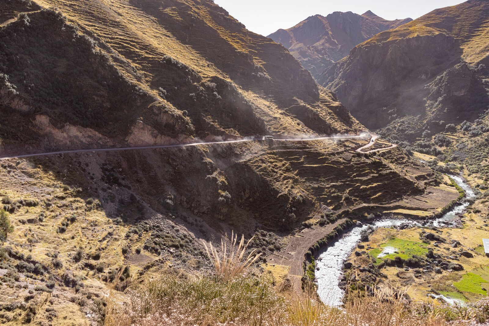
High mountain highway with steep gradients, switchbacks, landslide-prone sections, and elevation exceeding typical driving conditions.
Driving difficulty explained
Very high difficulty due to altitude, landslides, and rapidly changing mountain weather.
Route Snapshot Layer
Route Snapshot
This is a scenic driving route in Andes, Peru.
The route features moderate driving conditions.
It is classified as Extreme and is best suited for general road trip travelers.
Points of Interest
Attractions along the route
- HIguera de Pizarro — 180 m from route (20.6 km from start)
- Puento Augusto B. Leguia — 33 m from route (119.0 km from start)
- Arco de Ticlio — 53 m from route (154.3 km from start)
Places to eat
- Puro Huanal — 64 m from route (7.8 km from start)
- Kely's — 20 m from route (8.3 km from start)
- Chifa Yao Fu — 19 m from route (8.5 km from start)
- Chifa Joy Sam — 40 m from route (14.6 km from start)
Scenic viewpoints
- Cañon del Infiernillo — 116 m from route (122.1 km from start)
Interesting stops
- Hotel Peach Garden — 70 m from route (20.6 km from start)
Interesting stops
- 250 km a Lima — 5 m from route (273.1 km from start)
Actual Driving Track (GPX-data)
Download GPXGPS Data Layer
Measured Driving Route
This route is analyzed directly from GPX track data. It features a total distance of 312.8 km, with an elevation gain of 5168 m.
Route Structure
| Type | Distance (km) | Elevation Gain (m) | Avg Gradient (%) |
|---|---|---|---|
| flat | 192.55 km | 977 m | -0.2% |
| climb | 98.89 km | 4187 m | 4.2% |
| descent | 21.35 km | 4 m | -3.6% |
About this route
The Peru Andes High Altitude Scenic Highway Drive is one of the most scenic driving experiences in Peru. Located in Andes, this route offers a unique combination of landscapes, road conditions and natural highlights.
Stretching over 312.8 km, this drive takes approximately 7 hours.
This route is especially popular among travelers looking for road trips.
Travel Experience
We left early because we weren’t sure how the altitude would hit us later in the day. The first part felt normal enough, just rising roads and small towns, but you could already tell the air was getting thinner without really thinking about it.
At one stop we got out and immediately noticed how different it felt to move around. Not painful, just slightly harder to breathe than expected. We didn’t stay long and mostly just stood there looking at the road ahead.
There were long stretches where we barely spoke. The Peru Andes Highway kept climbing and dropping in a way that made it hard to judge progress. Someone asked how long the drive feels at this altitude, but nobody had a good comparison.
We stopped for a quick meal in a roadside place where everything took longer than expected. Tea, food, even just paying felt slow, and we ended up sitting there longer than planned just to rest.
Near the highest section, everything looked a bit sharper and more empty at the same time. We didn’t really focus on “best viewpoints along the road” anymore, we just pulled over when it felt necessary and then kept going through the Andes without overthinking it.
Best time to visit
The best time to explore the Peru Andes High Altitude Scenic Highway Drive is typically during spring and summer months, when weather conditions are stable and visibility is high. However, autumn offers fewer crowds and more dramatic scenery.
Travel tips
- Check road closures after heavy rain
- Allow time for altitude acclimatization
- Avoid night driving in mountain sections
Why visit
- Scenic landscapes unique to Andes
- Popular road trip destination in Peru
- Great for photography
- Varied terrain and driving conditions
Driving Interpretation Layer
What this route means
How long is this route?
The route is approximately 312.8 km long, with an elevation gain of 5168 m.
How difficult is the drive?
This route is classified as Extreme, with a maximum gradient of 8.4%.
What kind of terrain does it have?
This is a high alpine mountain route with significant elevation changes and exposed terrain.
What makes this route unique?
The route combines elevation variation (5168 m total gain) with changing landscapes shaped by natural geography and road conditions.
What type of driver is this route best suited for?
This route is best suited for experienced drivers comfortable with steep gradients, narrow mountain roads, and changing weather conditions.
Discovery Layer
More routes in Peru
About Peru →More similar scenic routes
Cusco to Sacred Valley Scenic Drive – Epic Andes Road Trip Through Peru’s Inca Heartland
High-altitude scenic loop connecting Cusco, the Sacred Valley, Inca ruins and traditional Andean villages

Route des Grandes Alpes Alpine Scenic Road Trip
High alpine route crossing multiple mountain passes.

Icefields Parkway Rocky Mountain Scenic Drive
One of the most scenic drives in the Canadian Rockies.

Blue Ridge Parkway Scenic Mountain Drive
Scenic mountain drive through the Appalachian Highlands.
Andes Scenic Mountain Drive
Wine region drive with Andes mountain backdrop.
Drakensberg Sani Pass Scenic Scenic Mountain Drive (Sani Pass → Lesotho entry)
Mountain drive along dramatic escarpments.