
Route Identity
Kotor Bay Fjord Scenic Drive
Montenegro — Bay of Kotor
Overview Layer
Overview
Discover the beautiful Kotor Bay Road in Montenegro. This stunning scenic drive circles the dramatic fjord-like bay, offering intense views and a breathtaking mountain road trip experience.
Weather
Mediterranean coastal fjord climate with hot dry summers, mild wet winters, and strong mountain-coastal weather interaction.
Seasonal Driving Conditions
Mild coastal conditions with increasing rainfall and moderate humidity in the bay area.
- moderate rainfall periods
- improving coastal visibility
Hot and dry conditions with stable coastal weather and high temperatures in sheltered bays.
- dry asphalt conditions
- stable driving weather
Cooling temperatures with increased rainfall and occasional coastal storm influence.
- increasing rainfall
- reduced visibility in bay areas
Mild but wet conditions with frequent rain and reduced visibility in mountainous coastal terrain.
- wet road surfaces
- fog in coastal mountain sections
Road conditions
Coastal mountain road with steep switchbacks, tunnels, and narrow sections exposed to weather and traffic.
Driving difficulty explained
Moderate to high difficulty due to steep gradients, narrow roads, and traffic in coastal sections.
Route Snapshot Layer
Route Snapshot
This is a scenic driving route in Bay of Kotor, Montenegro.
The route features moderate driving conditions.
It is classified as Hard and is best suited for general road trip travelers.
Points of Interest
Scenic viewpoints
- Trojica — 9 m from route (19.3 km from start)
Actual Driving Track (GPX-data)
Download GPXGPS Data Layer
Measured Driving Route
This route is analyzed directly from GPX track data. It features a total distance of 64.0 km, with an elevation gain of 3494 m.
Route Structure
| Type | Distance (km) | Elevation Gain (m) | Avg Gradient (%) |
|---|---|---|---|
| climb | 45.89 km | 3083 m | 4.5% |
| flat | 6.02 km | 235 m | -1% |
| descent | 12.06 km | 175 m | -3.8% |
About this route
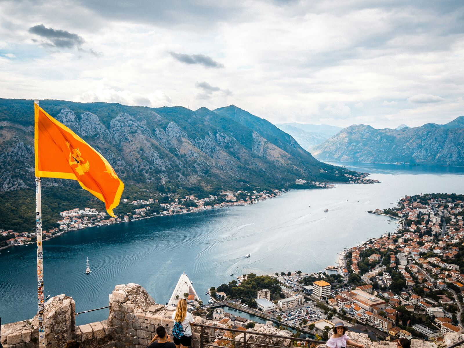
The Kotor Bay Fjord Scenic Drive is one of the most scenic driving experiences in Montenegro. Located in Bay of Kotor, this route offers a unique combination of landscapes, road conditions and natural highlights.
Stretching over 64.0 km, this drive takes approximately 2 hours.
This route is especially popular among travelers looking for road trips.
Travel Experience
We started pretty quickly because the road already looked like it was going to take more focus than expected. It doesn’t feel long on the map, but once you’re on it, it keeps turning in ways that make you slow down constantly.
At one viewpoint there were already a few cars pulled over and people standing right by the edge. We stayed only a few minutes because it was a bit crowded and the road behind us felt like it needed attention again.
There was a section where we just followed the bay for a while without talking much. The water kept appearing and disappearing between houses and bends, so it felt like you were never fully “done” looking at it.
We stopped in a small town for a quick coffee and ended up sitting longer than planned because parking felt slightly annoying to deal with again. Nothing special happened, just a break that turned into more of a pause.
By the end of the Kotor Bay Road, I remember mostly the constant turning and the feeling that the scenery was always just one corner away. It’s not a long drive, but it keeps your full attention the entire time.
Best time to visit
The best time to explore the Kotor Bay Fjord Scenic Drive is typically during spring and summer months, when weather conditions are stable and visibility is high. However, autumn offers fewer crowds and more dramatic scenery.
Travel tips
- Expect slow traffic in summer peak season
- Watch for sharp curves in tunnel sections
- Avoid driving in heavy rain due to reduced visibility
Why visit
- Scenic landscapes unique to Bay of Kotor
- Popular road trip destination in Montenegro
- Great for photography
- Varied terrain and driving conditions
Driving Interpretation Layer
What this route means
How long is this route?
The route is approximately 64.0 km long, with an elevation gain of 3494 m.
How difficult is the drive?
This route is classified as Hard, with a maximum gradient of 6.6%.
What kind of terrain does it have?
This is a relatively mild scenic route with steady and predictable driving conditions.
What makes this route unique?
The route combines elevation variation (3494 m total gain) with changing landscapes shaped by natural geography and road conditions.
What type of driver is this route best suited for?
This route is suitable for confident drivers who are comfortable with occasional steep sections and mountain terrain.
Discovery Layer
More routes in Montenegro
About Montenegro →More similar scenic routes
Durmitor National Park Scenic Loop Drive
Remote mountain loop through Durmitor National Park with high plateaus and dramatic peaks

Route des Grandes Alpes Alpine Scenic Road Trip
High alpine route crossing multiple mountain passes.

Icefields Parkway Rocky Mountain Scenic Drive
One of the most scenic drives in the Canadian Rockies.

Blue Ridge Parkway Scenic Mountain Drive
Scenic mountain drive through the Appalachian Highlands.
Drakensberg Sani Pass Scenic Scenic Mountain Drive (Sani Pass → Lesotho entry)
Mountain drive along dramatic escarpments.
Great Alpine Scenic Mountain Drive
Mountain road crossing Australian Alps.