
Route Identity
Mae Hong Son Loop Scenic Mountain Drive
Thailand — Northern Thailand
Overview Layer
Overview
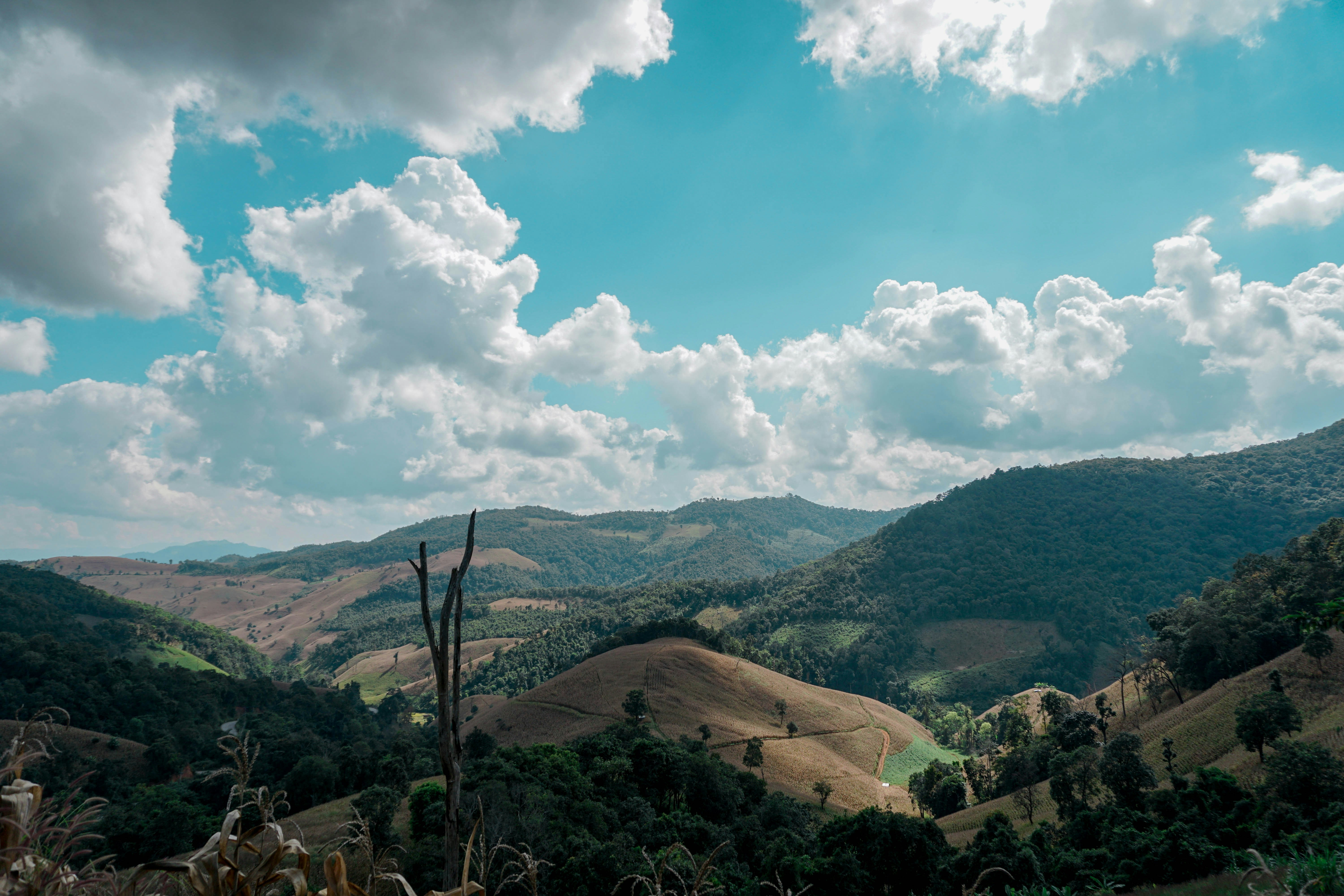
The Mae Hong Son Loop Scenic Mountain Drive is one of the most iconic road trips in northern Thailand, forming a long circular route through Chiang Mai, Pai, and Mae Hong Son. The journey passes through mountainous jungle landscapes, winding roads with countless curves, ethnic minority villages, and mist-covered valleys. It is a classic Southeast Asian road trip known for its variety of scenery and continuous elevation changes.
Weather
Tropical monsoon climate with distinct wet and dry seasons and significant rainfall variation.
Seasonal Driving Conditions
Dry and hot conditions with increasing temperatures.
- increasing heat levels
- dry road conditions
Monsoon season with heavy rainfall and reduced visibility.
- heavy rainfall
- reduced visibility and traction
Transition period with decreasing rainfall and improving road conditions.
- improving road stability
- decreasing rainfall
Cool and dry conditions with stable road accessibility.
- stable dry conditions
- good visibility in mountain areas
Road conditions
Mountain loop with steep curves, variable pavement quality, and landslide risk during monsoon season.
Driving difficulty explained
Moderate difficulty due to mountainous terrain and seasonal rainfall impact.
Route Snapshot Layer
Route Snapshot
This is a scenic driving route in Northern Thailand, Thailand.
The route features moderate driving conditions.
It is classified as Extreme and is best suited for general road trip travelers.
Points of Interest
Scenic viewpoints
- จุดชมวิวรักจัง — 103 m from route (78.4 km from start)
- Doi Kiew Lom Viewpoint — 13 m from route (166.0 km from start)
- จุดชมวิวบ้านจาโบ่ — 95 m from route (192.9 km from start)
- Free Looking — 93 m from route (281.7 km from start)
Attractions along the route
- Bamboo bridge on the paddy's field — 12 m from route (123.6 km from start)
Actual Driving Track (GPX-data)
Download GPXGPS Data Layer
Measured Driving Route
This route is analyzed directly from GPX track data. It features a total distance of 634.0 km, with an elevation gain of 10177 m.
Route Structure
| Type | Distance (km) | Elevation Gain (m) | Avg Gradient (%) |
|---|---|---|---|
| flat | 345.28 km | 2025 m | 0% |
| climb | 141.11 km | 7935 m | 5.5% |
| descent | 147.57 km | 216 m | -5.4% |
About this route
The Mae Hong Son Loop Scenic Mountain Drive is one of the most scenic driving experiences in Thailand. Located in Northern Thailand, this route offers a unique combination of landscapes, road conditions and natural highlights.
Stretching over 634.0 km, this drive takes approximately 13 hours.
This route is especially popular among travelers looking for road trips.
Travel Experience
The loop starts out feeling manageable, but very quickly you realize the road is going to define the entire experience more than any single destination.
At first stops we were still trying to keep a schedule, but after a while it became clear that progress would naturally slow down because of the constant curves and elevation changes.
There were long stretches where the road twisted through forested mountains with almost no straight sections, and the drive itself became the main focus of attention.
We stopped in Pai and ended up staying longer than planned because the atmosphere felt more relaxed than anywhere else on the route. It naturally breaks the journey into phases.
By the end of the Mae Hong Son Loop, the memory wasn’t tied to one viewpoint but to the rhythm of driving itself — endless bends, changing climates, and small towns appearing between mountains.
Best time to visit
The best time to explore the Mae Hong Son Loop Scenic Mountain Drive is typically during spring and summer months, when weather conditions are stable and visibility is high. However, autumn offers fewer crowds and more dramatic scenery.
Travel tips
- Avoid travel during peak monsoon months
- Check for landslide warnings
- Expect steep and winding road sections
Why visit
- Scenic landscapes unique to Northern Thailand
- Popular road trip destination in Thailand
- Great for photography
- Varied terrain and driving conditions
Driving Interpretation Layer
What this route means
How long is this route?
The route is approximately 634.0 km long, with an elevation gain of 10177 m.
How difficult is the drive?
This route is classified as Extreme, with a maximum gradient of 15.9%.
What kind of terrain does it have?
This route features hilly terrain with several steep driving sections.
What makes this route unique?
The route combines elevation variation (10177 m total gain) with changing landscapes shaped by natural geography and road conditions.
What type of driver is this route best suited for?
This route is best suited for experienced drivers comfortable with steep gradients, narrow mountain roads, and changing weather conditions.
Discovery Layer
More routes in Thailand
About Thailand →More similar scenic routes
Northern Thailand Mountain Scenic Loop Drive
Mountain roads and temples in northern Thailand.

Route des Grandes Alpes Alpine Scenic Road Trip
High alpine route crossing multiple mountain passes.

Icefields Parkway Rocky Mountain Scenic Drive
One of the most scenic drives in the Canadian Rockies.

Blue Ridge Parkway Scenic Mountain Drive
Scenic mountain drive through the Appalachian Highlands.
Drakensberg Sani Pass Scenic Scenic Mountain Drive (Sani Pass → Lesotho entry)
Mountain drive along dramatic escarpments.
Great Alpine Scenic Mountain Drive
Mountain road crossing Australian Alps.