
Route Identity
Leh–Manali Himalayan Scenic Highway Drive
India — Ladakh
Overview Layer
Overview
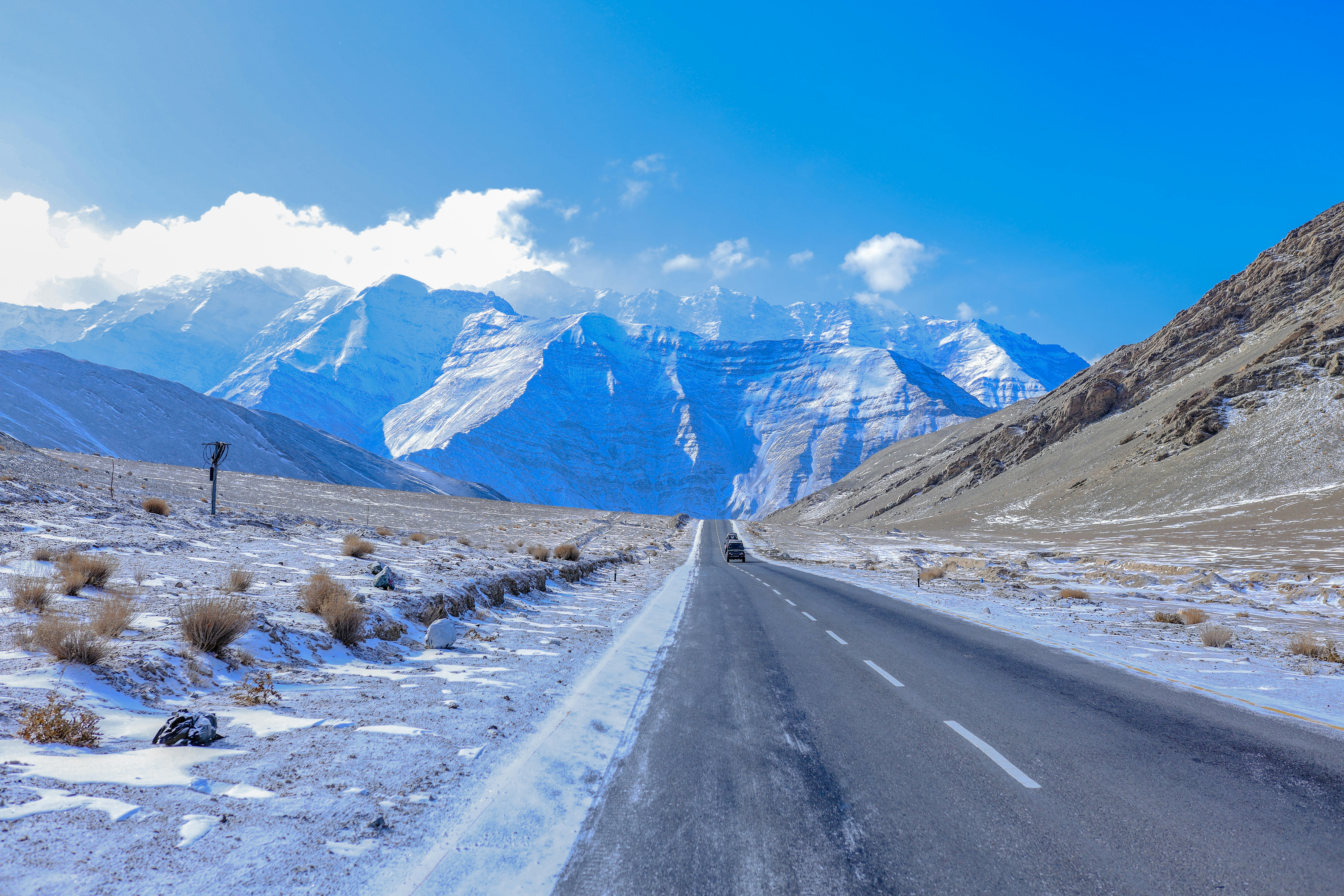
The Leh–Manali Highway is one of the most famous road trips in India and one of the highest scenic highways in the world. Connecting Himachal Pradesh with Ladakh, the route crosses multiple Himalayan passes above 4,000 meters, traverses high-altitude deserts, rugged mountain landscapes, and some of the most remote regions accessible by road. For many travelers, it is the ultimate Himalayan driving experience.
Weather
High-altitude alpine and cold desert climate with large temperature variations and seasonal snowfall affecting accessibility.
Seasonal Driving Conditions
Road sections may remain partially closed due to snow at high passes.
- partial snow clearance on high passes
- unstable sections due to melting snow
Main open season with accessible high mountain passes and active road maintenance.
- full route accessibility
- ongoing road maintenance activity
Stable but cooling conditions before seasonal closure of high passes.
- stable but cooling temperatures
- reduced landslide risk compared to monsoon
Heavy snowfall leading to closure of most high-altitude sections.
- road closures at high passes
- heavy snowfall accumulation
Road conditions
High mountain highway with multiple high passes, subject to landslides in monsoon season and snow blockage in winter.
Driving difficulty explained
High difficulty due to altitude, weather volatility, and risk of landslides.
Route Snapshot Layer
Route Snapshot
This is a scenic driving route in Ladakh, India.
The route features moderate driving conditions.
It is classified as Extreme and is best suited for general road trip travelers.
Points of Interest
Attractions along the route
- Curved Buddha — 11 m from route (10.6 km from start)
- Baralacha La — 12 m from route (268.1 km from start)
- Stone carved scriptures — 35 m from route (338.7 km from start)
Scenic viewpoints
- View on Shey Palace — 76 m from route (26.4 km from start)
Cafés and stops
- Analog — 20 m from route (0.4 km from start)
Places to eat
- Bed & food — 44 m from route (238.0 km from start)
- Food & bed (Dhaba) — 39 m from route (282.2 km from start)
- Snowland Hotel and Restaurant — 47 m from route (335.6 km from start)
Interesting stops
- Womens' Association — 36 m from route (0.0 km from start)
- Path starts behind ad signs — 43 m from route (434.2 km from start)
Actual Driving Track (GPX-data)
Download GPXGPS Data Layer
Measured Driving Route
This route is analyzed directly from GPX track data. It features a total distance of 435.0 km, with an elevation gain of 5745 m.
Route Structure
| Type | Distance (km) | Elevation Gain (m) | Avg Gradient (%) |
|---|---|---|---|
| descent | 144.22 km | 57 m | -4.5% |
| flat | 181.82 km | 1372 m | 0.3% |
| climb | 108.99 km | 4316 m | 4% |
About this route
The Leh–Manali Himalayan Scenic Highway Drive is one of the most scenic driving experiences in India. Located in Ladakh, this route offers a unique combination of landscapes, road conditions and natural highlights.
Stretching over 435.0 km, this drive takes approximately 9 hours.
This route is especially popular among travelers looking for road trips.
Travel Experience
The altitude became part of the day much sooner than we expected. Even simple stops felt different, and everyone seemed to be paying more attention to how they felt than on a normal road trip.
At one mountain pass there were dozens of vehicles pulled over, but nobody stayed very long. People took a few photos, looked around, and then moved on, probably because of the cold and thin air.
There were stretches where we drove for what felt like hours without seeing much beyond mountains, gravel, and sky. The landscape was huge, but also strangely empty at the same time.
We stopped at a roadside camp for food and tea, and it felt less like a café and more like a necessary checkpoint between long sections of road. Everyone there seemed to be traveling the same route.
By the end of the Leh–Manali Highway, I remembered the scale more than any specific viewpoint. The distances, the altitude, and the feeling of being far from everything else made the drive seem much longer than the numbers on a map.
Best time to visit
The best time to explore the Leh–Manali Himalayan Scenic Highway Drive is typically during spring and summer months, when weather conditions are stable and visibility is high. However, autumn offers fewer crowds and more dramatic scenery.
Travel tips
- Acclimatize to high altitude before travel
- Check pass closures before departure
- Expect limited services along the route
Why visit
- Scenic landscapes unique to Ladakh
- Popular road trip destination in India
- Great for photography
- Varied terrain and driving conditions
Driving Interpretation Layer
What this route means
How long is this route?
The route is approximately 435.0 km long, with an elevation gain of 5745 m.
How difficult is the drive?
This route is classified as Extreme, with a maximum gradient of 7.1%.
What kind of terrain does it have?
This is a high alpine mountain route with significant elevation changes and exposed terrain.
What makes this route unique?
The route combines elevation variation (5745 m total gain) with changing landscapes shaped by natural geography and road conditions.
What type of driver is this route best suited for?
This route is best suited for experienced drivers comfortable with steep gradients, narrow mountain roads, and changing weather conditions.
Discovery Layer
More routes in India
About India →More similar scenic routes
Kerala Backwaters Scenic Drive
Lush tropical landscapes and waterways.
Kathmandu–Pokhara Himalayan Scenic Drive
Mountain highway following river valleys between Nepal’s two most popular travel hubs
Kathmandu to Ramechhap (Manthali Airport) Epic Himalayan Scenic Transfer Drive Experience
Mountain transfer drive through Nepal’s hills connecting Kathmandu with Ramechhap airport via winding Himalayan roads