Route Identity
Kerala Backwaters Scenic Drive
India — Kerala
Overview Layer
Overview
Explore the serene Kerala Backwaters Drive in India. This easy tropical road trip winds through lush green landscapes, serene backwaters, and charming small towns, offering a relaxing and deeply immersive natural Indian experience.
Weather
Tropical monsoon climate with heavy seasonal rainfall, high humidity, and stable warm temperatures year-round.
Seasonal Driving Conditions
Hot and humid conditions with increasing pre-monsoon rainfall.
- high humidity levels
- increasing pre-monsoon showers
Heavy monsoon rainfall with saturated roads and high humidity.
- monsoon rainfall dominates
- waterlogged rural roads
Post-monsoon transition with decreasing rainfall and improving road conditions.
- improving drainage conditions
- reduced rainfall frequency
Mild and relatively dry conditions with stable travel environment.
- dry and stable roads
- comfortable driving temperatures
Road conditions
Lowland coastal and rural roads with frequent wet surfaces during monsoon and congestion near settlements.
Driving difficulty explained
Moderate difficulty due to monsoon flooding and traffic density in rural and urban transitions.
Route Snapshot Layer
Route Snapshot
This is a scenic driving route in Kerala, India.
The route features moderate driving conditions.
It is classified as Hard and is best suited for general road trip travelers.
Points of Interest
Scenic viewpoints
- Thaneermukkom Bund Viewpoint — 37 m from route (131.9 km from start)
- Thanneermukkam bund — 92 m from route (132.2 km from start)
Attractions along the route
- Zip Line Vagamon — 31 m from route (61.8 km from start)
Places to eat
- Taj Resturant — 7 m from route (15.8 km from start)
- Hotel Komalam — 4 m from route (93.8 km from start)
- Freak Inn — 8 m from route (97.1 km from start)
Interesting stops
- KFC — 18 m from route (92.7 km from start)
Cafés and stops
- Anns — 26 m from route (94.7 km from start)
Actual Driving Track (GPX-data)
Download GPXGPS Data Layer
Measured Driving Route
This route is analyzed directly from GPX track data. It features a total distance of 133.3 km, with an elevation gain of 3462 m.
Route Structure
| Type | Distance (km) | Elevation Gain (m) | Avg Gradient (%) |
|---|---|---|---|
| descent | 32.19 km | 1002 m | -4.4% |
| flat | 87.07 km | 1668 m | -0.1% |
| climb | 14.05 km | 792 m | 3.2% |
About this route
The Kerala Backwaters Scenic Drive is one of the most scenic driving experiences in India. Located in Kerala, this route offers a unique combination of landscapes, road conditions and natural highlights.
Stretching over 133.3 km, this drive takes approximately 3 hours.
This route is especially popular among travelers looking for road trips.
Travel Experience
We started driving before it got too hot, but it didn’t really matter much because the air stayed humid the whole time anyway. The first stretch was just small towns and green edges along the road.
At one point we stopped near a bridge because there was space and a few people were already standing there looking at the water. It wasn’t a planned viewpoint, just somewhere you naturally slow down and look around for a bit.
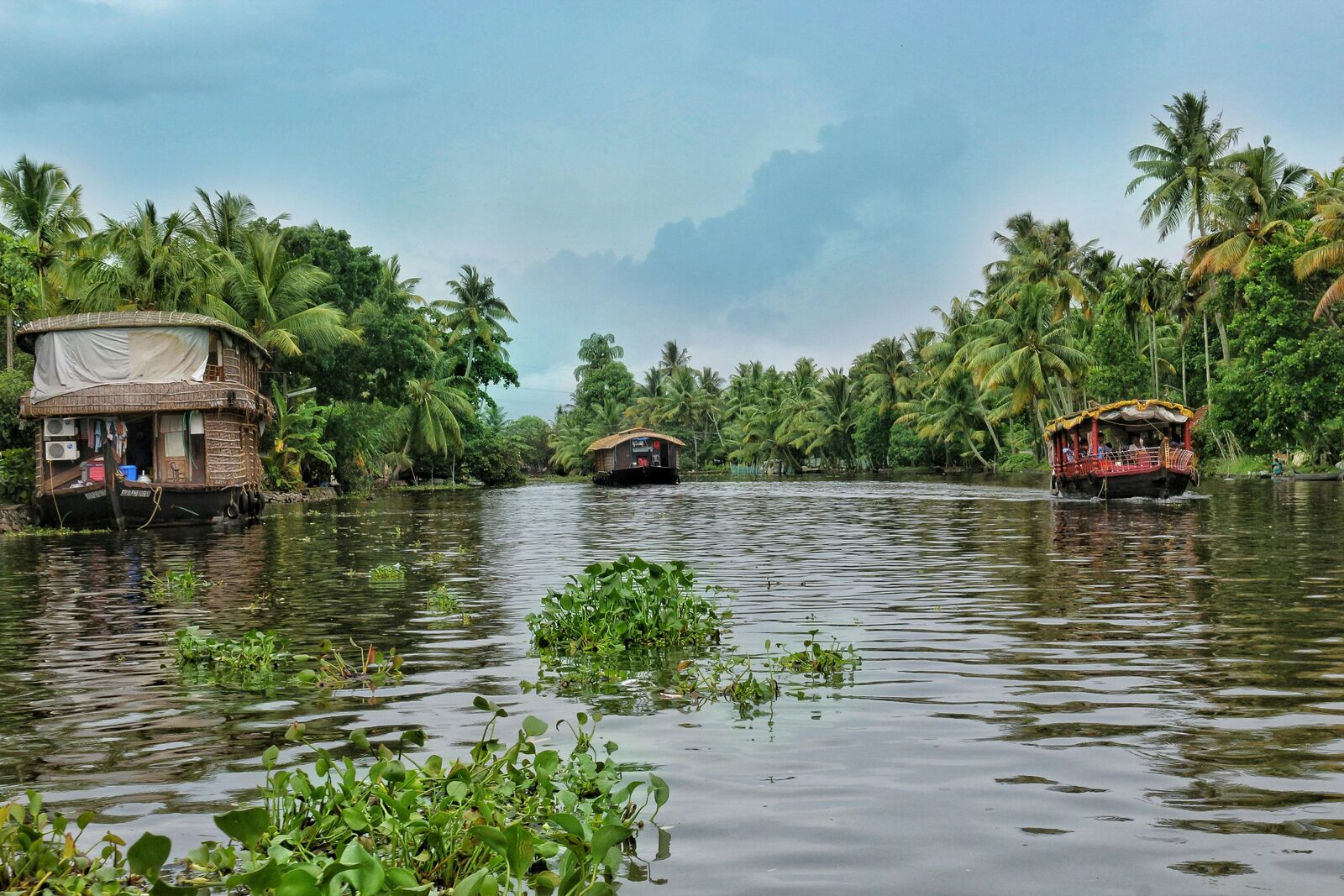
There were long sections where everything felt close to the road—water channels, palm trees, small houses—so we didn’t really feel the need to stop often. We mostly just kept moving and commenting occasionally when a boat passed by.
We stopped for food in a roadside place that felt half open to the air, half sheltered from it. Service was relaxed and slow in a way that didn’t feel like a problem, just a necessary break.
By the end of the Kerala Backwaters Drive, it felt less like a single route and more like passing through connected stretches of water and greenery. The drive itself was easy, but everything outside the car kept pulling attention in short, casual moments rather than big stops.
Best time to visit
The best time to explore the Kerala Backwaters Scenic Drive is typically during spring and summer months, when weather conditions are stable and visibility is high. However, autumn offers fewer crowds and more dramatic scenery.
Travel tips
- Avoid peak monsoon travel periods
- Watch for waterlogged rural roads
- Expect slow traffic near settlements
Why visit
- Scenic landscapes unique to Kerala
- Popular road trip destination in India
- Great for photography
- Varied terrain and driving conditions
Driving Interpretation Layer
What this route means
How long is this route?
The route is approximately 133.3 km long, with an elevation gain of 3462 m.
How difficult is the drive?
This route is classified as Hard, with a maximum gradient of 5.2%.
What kind of terrain does it have?
This is a relatively mild scenic route with steady and predictable driving conditions.
What makes this route unique?
The route combines elevation variation (3462 m total gain) with changing landscapes shaped by natural geography and road conditions.
What type of driver is this route best suited for?
This route is suitable for most drivers, including casual travelers looking for a scenic and relaxed drive.
Discovery Layer