
Route Identity
Kathmandu–Pokhara Himalayan Scenic Drive
Nepal — Central Nepal
Overview Layer
Overview
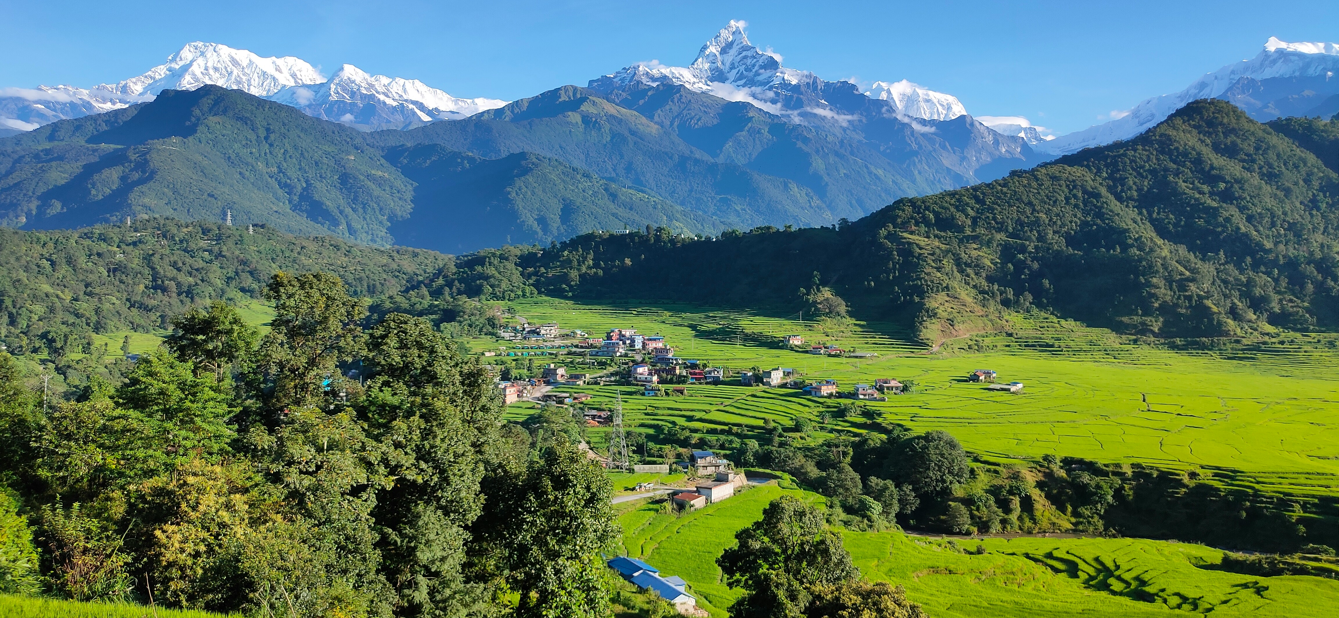
The Kathmandu–Pokhara Drive is one of the most important and scenic road trips in Nepal, connecting the capital city with the gateway to the Annapurna region. The route follows winding river valleys through hills, villages, and mountain landscapes, offering travelers a classic introduction to Nepal's geography beyond the cities. It is one of the most traveled highways in the country and a key route for visitors heading toward the Himalayas.
Weather
Subtropical to temperate climate influenced by monsoon cycles with distinct wet and dry seasons.
Seasonal Driving Conditions
Stable temperatures with moderate visibility and occasional rainfall.
- moderate rainfall
- stable road conditions outside heavy rain periods
Monsoon season with heavy rainfall and reduced visibility.
- monsoon rains affecting visibility
- increased landslide risk
Dry and stable weather conditions with improved visibility.
- dry and stable driving conditions
- improved visibility in mountain areas
Cool temperatures with generally dry conditions and clear skies.
- cool temperatures
- generally clear road conditions
Road conditions
Hilly terrain with winding roads, variable pavement quality, and monsoon-related landslide risk.
Driving difficulty explained
Moderate difficulty due to mountainous terrain and monsoon-related disruptions.
Route Snapshot Layer
Route Snapshot
This is a scenic driving route in Central Nepal, Nepal.
The route features moderate driving conditions.
It is classified as Hard and is best suited for general road trip travelers.
Points of Interest
Attractions along the route
- Club Galaxy — 149 m from route (192.6 km from start)
- S-Style Dance Institute — 75 m from route (193.1 km from start)
Interesting stops
- Shena Fast Food — 4 m from route (92.2 km from start)
Places to eat
- Naubise Hotel and Khana Khaja Point — 23 m from route (172.7 km from start)
Actual Driving Track (GPX-data)
Download GPXGPS Data Layer
Measured Driving Route
This route is analyzed directly from GPX track data. It features a total distance of 197.8 km, with an elevation gain of 3078 m.
Route Structure
| Type | Distance (km) | Elevation Gain (m) | Avg Gradient (%) |
|---|---|---|---|
| flat | 140.37 km | 1338 m | -0.2% |
| descent | 21.83 km | 36 m | -3% |
| climb | 35.63 km | 1704 m | 4.3% |
About this route
The Kathmandu–Pokhara Himalayan Scenic Drive is one of the most scenic driving experiences in Nepal. Located in Central Nepal, this route offers a unique combination of landscapes, road conditions and natural highlights.
Stretching over 197.8 km, this drive takes approximately 4 hours.
This route is especially popular among travelers looking for road trips.
Travel Experience
We left Kathmandu early hoping to avoid traffic, but it still took a while before the city finally disappeared behind us. Once the road reached the hills, the pace slowed down and stayed that way for most of the day.
For long stretches the road followed a river below. Sometimes it was right beside us, and other times it seemed far down in the valley, only visible through gaps in the trees.
There were plenty of roadside places selling snacks, tea, and simple meals. We stopped at one without really choosing it — everyone else seemed to be stopping there too.
At one point roadwork brought traffic almost to a standstill. Nobody looked surprised. Drivers got out, stretched their legs, and waited as if this was just part of the journey.
By the time we reached Pokhara, the drive felt less like a scenic route and more like a cross-section of everyday Nepal. Villages, rivers, buses, mountains, and construction all seemed to share the same narrow corridor.
Best time to visit
The best time to explore the Kathmandu–Pokhara Himalayan Scenic Drive is typically during spring and summer months, when weather conditions are stable and visibility is high. However, autumn offers fewer crowds and more dramatic scenery.
Travel tips
- Avoid travel during heavy monsoon rainfall
- Monitor road closures due to landslides
- Expect variable driving speeds on mountain roads
Why visit
- Scenic landscapes unique to Central Nepal
- Popular road trip destination in Nepal
- Great for photography
- Varied terrain and driving conditions
Driving Interpretation Layer
What this route means
How long is this route?
The route is approximately 197.8 km long, with an elevation gain of 3078 m.
How difficult is the drive?
This route is classified as Hard, with a maximum gradient of 9.4%.
What kind of terrain does it have?
This route features hilly terrain with several steep driving sections.
What makes this route unique?
The route combines elevation variation (3078 m total gain) with changing landscapes shaped by natural geography and road conditions.
What type of driver is this route best suited for?
This route is suitable for confident drivers who are comfortable with occasional steep sections and mountain terrain.
Discovery Layer
More routes in Nepal
About Nepal →More similar scenic routes
Kathmandu to Ramechhap (Manthali Airport) Epic Himalayan Scenic Transfer Drive Experience
Mountain transfer drive through Nepal’s hills connecting Kathmandu with Ramechhap airport via winding Himalayan roads
Leh–Manali Himalayan Scenic Highway Drive
Legendary Himalayan highway crossing high mountain passes, deserts and remote valleys