
Route Identity
Gauja Valley Scenic Nature Drive
Latvia — Gauja
Overview Layer
Overview
The Gauja Valley Route follows one of Latvia’s most scenic regions, winding through river valleys, sandstone cliffs, forests, and historic towns. It is a popular road trip for travelers exploring the landscapes of Gauja National Park.
Weather
Temperate continental forest valley climate with cold winters, mild summers, and frequent humidity and fog in low-lying river areas.
Seasonal Driving Conditions
Cool temperatures with snowmelt increasing river levels and wet forest road surfaces.
- river level rise from snowmelt
- wet forest road surfaces
Mild continental climate with stable weather and generally dry driving conditions.
- stable dry driving conditions
- clear visibility in valley sections
Cooling temperatures with frequent fog in forest valleys and increased rainfall.
- frequent fog in river valley
- wet leaf accumulation on roads
Cold conditions with snow cover and icy rural road sections in shaded areas.
- snow-covered rural roads
- icy shaded forest sections
Road conditions
Paved rural and forest roads with gentle elevation changes and occasional reduced traction during wet or icy periods.
Driving difficulty explained
Low to moderate difficulty due to weather-related traction changes rather than terrain complexity.
Route Snapshot Layer
Route Snapshot
This is a scenic driving route in Gauja, Latvia.
The route features moderate driving conditions.
It is classified as Moderate and is best suited for general road trip travelers.
Points of Interest
Scenic viewpoints
- Valmieras Svētā Sīmaņa Baznīcas Skatpunkts — 23 m from route (3.9 km from start)
- Skats uz Gūdu iezi — 53 m from route (63.6 km from start)
- Raganu katls — 2 m from route (79.6 km from start)
Attractions along the route
- Spriņģu iezis — 46 m from route (59.2 km from start)
- Viktora vēstules — 77 m from route (85.0 km from start)
- Atpūtas parks "Rāmkalni" — 42 m from route (101.2 km from start)
Actual Driving Track (GPX-data)
Download GPXGPS Data Layer
Measured Driving Route
This route is analyzed directly from GPX track data. It features a total distance of 153.0 km, with an elevation gain of 1914 m.
Route Structure
| Type | Distance (km) | Elevation Gain (m) | Avg Gradient (%) |
|---|---|---|---|
| flat | 148.97 km | 1799 m | 0% |
| climb | 2 km | 88 m | 3.4% |
| descent | 2.02 km | 28 m | -3.1% |
About this route
The Gauja Valley Scenic Nature Drive is one of the most scenic driving experiences in Latvia. Located in Gauja, this route offers a unique combination of landscapes, road conditions and natural highlights.
Stretching over 153.0 km, this drive takes approximately 4 hours.
This route is especially popular among travelers looking for road trips.
Travel Experience
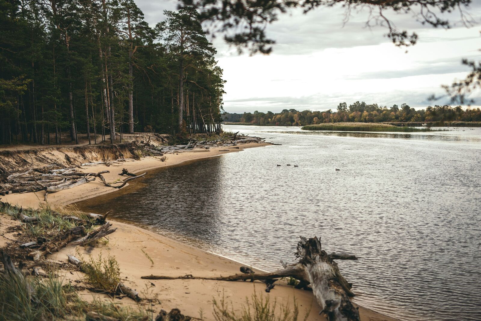
We started fairly casually, not really expecting anything intense since the distance is short, but the first stretch already felt slower because of the winding roads along the river.
At one stop near the sandstone cliffs there were a few other cars parked and people walking down a trail. We followed part of it, but turned back quickly because it was a bit muddier than it looked from above.
There were sections where the road kept hugging the Gauja River and then pulling away into forest again. We didn’t really talk much, just occasionally pointing out kayaks or people fishing along the banks.
We stopped in a small town for food and ended up sitting longer than planned just because it was easier than getting moving again immediately. Nothing memorable about the stop itself, just a quiet break.
By the end of the Gauja Valley Route, it felt like a simple loop of river views, cliffs, and forest patches. Nothing felt like a major highlight, but the steady presence of the valley made the whole drive feel calm and consistent without needing much attention.
Best time to visit
The best time to explore the Gauja Valley Scenic Nature Drive is typically during spring and summer months, when weather conditions are stable and visibility is high. However, autumn offers fewer crowds and more dramatic scenery.
Travel tips
- Expect fog in valley areas during autumn mornings
- Watch for icy patches in winter shaded roads
- Drive cautiously on wet forest sections after rain
Why visit
- Scenic landscapes unique to Gauja
- Popular road trip destination in Latvia
- Great for photography
- Varied terrain and driving conditions
Driving Interpretation Layer
What this route means
How long is this route?
The route is approximately 153.0 km long, with an elevation gain of 1914 m.
How difficult is the drive?
This route is classified as Moderate, with a maximum gradient of 3.4%.
What kind of terrain does it have?
This is a relatively mild scenic route with steady and predictable driving conditions.
What makes this route unique?
The route combines elevation variation (1914 m total gain) with changing landscapes shaped by natural geography and road conditions.
What type of driver is this route best suited for?
This route is suitable for most drivers, including casual travelers looking for a scenic and relaxed drive.
More similar scenic routes
Patagonia Lakes Scenic Route Drive
Remote Patagonian road with lakes and glaciers.
Norwegian Fjords Scenic Drive
Epic fjord landscapes with cliffs and waterfalls.
Carretera Austral Patagonian Scenic Highway
Remote Patagonian road through forests, fjords and glaciers.
Extended Garden Route Scenic Drive
Extended coastal drive with beaches and forests.
Tasmania Wilderness Scenic Drive
Wild nature drive through Tasmania’s forests and coasts.
South Island Scenic Scenic Road Trip
Epic road through fjords, mountains and lakes.