
Route Identity
Yukon Wilderness Northern Scenic Drive
Canada — Yukon
Overview Layer
Overview
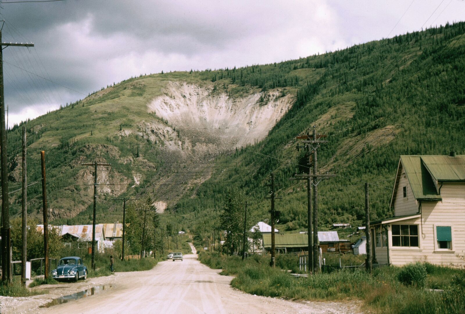
Experience the wild and remote Yukon Scenic Drive in Canada. This unforgettable road trip takes you through vast northern forests and open wilderness, offering a truly authentic and adventurous Canadian experience.
Weather
Subarctic climate with long winters, short mild summers, and strong seasonal temperature extremes.
Seasonal Driving Conditions
Cold conditions with late snowmelt and partially thawed road surfaces.
- snowmelt affecting road stability
- muddy and soft shoulder areas
Mild temperatures with long daylight hours and generally stable road access.
- stable dry road surfaces
- extended daylight driving conditions
Rapid cooling with early snowfall and increasing precipitation.
- early frost and icy patches
- increasing precipitation
Extreme cold with snow-covered roads and limited travel accessibility.
- snow-covered roads
- limited maintenance and closures in remote areas
Road conditions
Long remote highways with gravel and paved sections, affected by frost heave and seasonal maintenance limits.
Driving difficulty explained
High difficulty due to remoteness, extreme winter conditions, and long distances between services.
Route Snapshot Layer
Route Snapshot
This is a scenic driving route in Yukon, Canada.
The route features moderate driving conditions.
It is classified as Moderate and is best suited for general road trip travelers.
Points of Interest
Attractions along the route
- Paddlewheel — 53 m from route (6.9 km from start)
Scenic viewpoints
- Teslin Lake — 200 m from route (175.3 km from start)
Places to eat
- Legends Smokehouse & Grill — 40 m from route (0.1 km from start)
- Asahita Sushi — 153 m from route (0.7 km from start)
- Andrea's Restaurant — 26 m from route (438.5 km from start)
Interesting stops
- Quiznos — 143 m from route (0.0 km from start)
- Daat Indian Cuisine — 138 m from route (0.0 km from start)
Interesting stops
- Yukon Motel Gas — 65 m from route (178.8 km from start)
Actual Driving Track (GPX-data)
Download GPXGPS Data Layer
Measured Driving Route
This route is analyzed directly from GPX track data. It features a total distance of 438.5 km, with an elevation gain of 2533 m.
Route Structure
| Type | Distance (km) | Elevation Gain (m) | Avg Gradient (%) |
|---|---|---|---|
| flat | 403.39 km | 2101 m | 0% |
| climb | 15.45 km | 431 m | 2.8% |
| descent | 19.63 km | 2 m | -2.6% |
About this route
The Yukon Wilderness Northern Scenic Drive is one of the most scenic driving experiences in Canada. Located in Yukon, this route offers a unique combination of landscapes, road conditions and natural highlights.
Stretching over 438.5 km, this drive takes approximately 9 hours.
This route is especially popular among travelers looking for road trips.
Travel Experience
We left with a full tank and still checked it more often than we needed to. The first couple of hours were mostly forest and long straight sections where nothing really changed, just trees and road.
At one stop there was a small pullout with a few other vehicles and people just standing quietly. Nobody really said much, we just stepped out, stretched, and got back in again. It felt more like a checkpoint than a viewpoint.
There were long stretches where we didn’t see anyone else for a while, which felt normal after a bit but a little strange at the start. We mostly just talked about random things and then went quiet again.
We stopped for food in a place that didn’t feel like it was expecting many travelers at that exact moment. The menu was simple and it took a while, but that actually worked fine because we needed the break anyway.
By the time we were deeper into the Yukon Scenic Drive, the distance between stops started to feel less important than just keeping going. It wasn’t about viewpoints or anything specific anymore, just long stretches of northern road and forests repeating in different versions.
Best time to visit
The best time to explore the Yukon Wilderness Northern Scenic Drive is typically during spring and summer months, when weather conditions are stable and visibility is high. However, autumn offers fewer crowds and more dramatic scenery.
Travel tips
- Plan fuel stops carefully due to long distances
- Prepare for limited communication coverage
- Carry emergency supplies in all seasons
Why visit
- Scenic landscapes unique to Yukon
- Popular road trip destination in Canada
- Great for photography
- Varied terrain and driving conditions
Driving Interpretation Layer
What this route means
How long is this route?
The route is approximately 438.5 km long, with an elevation gain of 2533 m.
How difficult is the drive?
This route is classified as Moderate, with a maximum gradient of 3.7%.
What kind of terrain does it have?
This is a relatively mild scenic route with steady and predictable driving conditions.
What makes this route unique?
The route combines elevation variation (2533 m total gain) with changing landscapes shaped by natural geography and road conditions.
What type of driver is this route best suited for?
This route is suitable for most drivers, including casual travelers looking for a scenic and relaxed drive.
Discovery Layer
More routes in Canada
About Canada →
Icefields Parkway Rocky Mountain Scenic Drive
One of the most scenic drives in the Canadian Rockies.
Cabot Trail
Iconic Atlantic coastal loop with cliffs, forests and sweeping ocean views
Sea-to-Sky Highway Ultimate Coastal Mountain Scenic Drive – Vancouver to Whistler Experience
Stunning coastal highway linking Vancouver with Whistler through fjords, waterfalls and mountain peaks
More similar scenic routes
Icefields Parkway Rocky Mountain Scenic Drive
One of the most scenic drives in the Canadian Rockies.
Mongolia Central Steppe Scenic Highway Route (Ulaanbaatar Corridor)
Endless open steppe landscapes.
Cabot Trail
Iconic Atlantic coastal loop with cliffs, forests and sweeping ocean views
Sea-to-Sky Highway Ultimate Coastal Mountain Scenic Drive – Vancouver to Whistler Experience
Stunning coastal highway linking Vancouver with Whistler through fjords, waterfalls and mountain peaks