Route Identity
Mongolia Central Steppe Scenic Highway Route (Ulaanbaatar Corridor)
Mongolia — Central Mongolia
Overview Layer
Overview
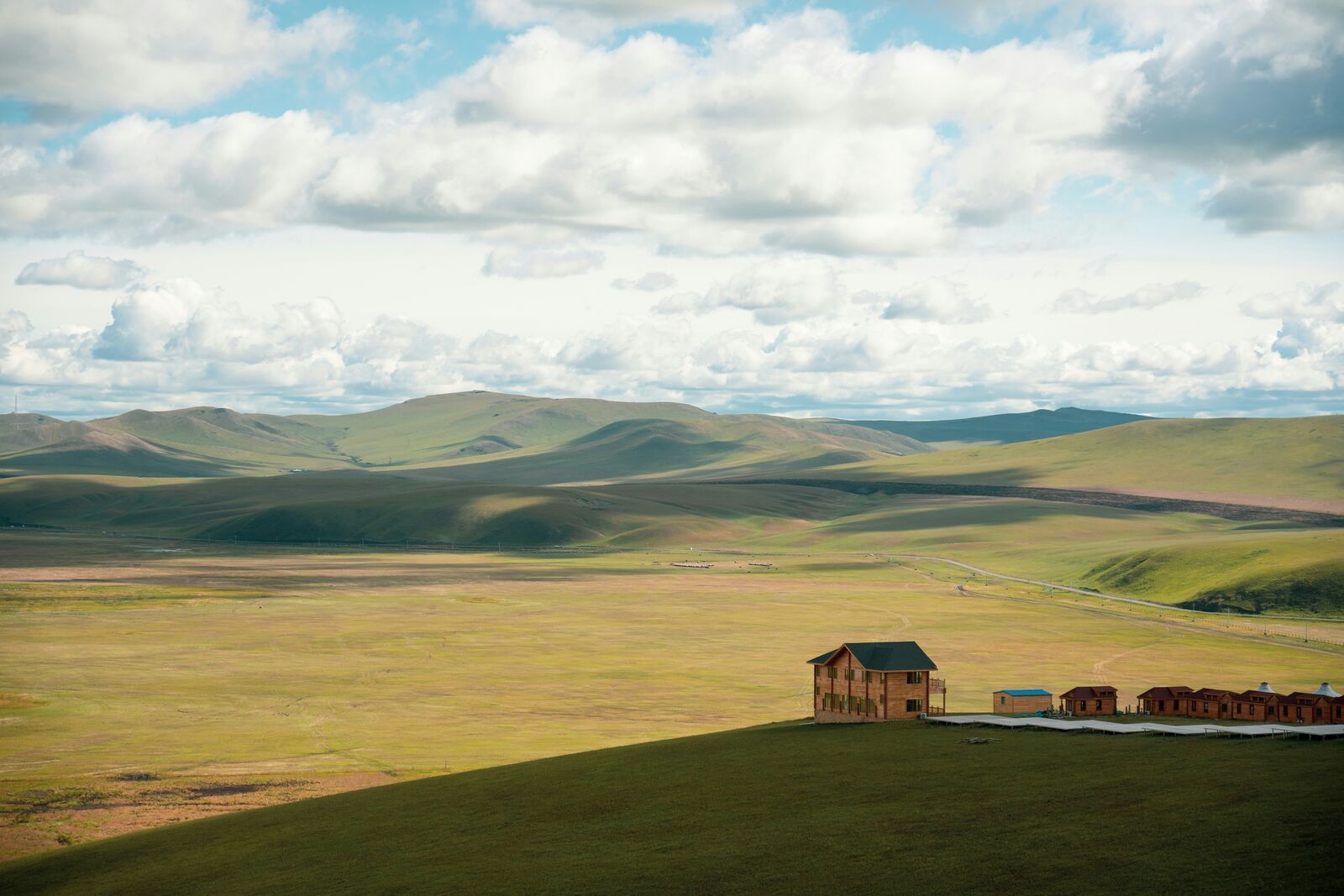
Experience the immense and wild Mongolian Steppe Drive. This rugged road trip offers an unforgettable taste of open space and endless horizon in Central Mongolia, providing a unique journey across the vast grasslands.
Weather
Continental steppe climate with extreme seasonal temperature variation, low precipitation, and strong winds.
Seasonal Driving Conditions
Cold and windy conditions with melting snow and dusty roads in open steppe areas.
- dusty road conditions
- strong winds across open plains
Warm and dry conditions with stable but hot daytime temperatures in open plains.
- stable dry tracks
- high daytime heat exposure
Cooling temperatures with dry and stable driving conditions.
- comfortable temperatures
- dry and firm road surfaces
Extreme cold with snow cover, strong winds, and limited accessibility in remote regions.
- snow-covered steppe routes
- extreme cold affecting traction
Road conditions
Unpaved steppe tracks and long-distance gravel roads with minimal infrastructure and exposure to weather extremes.
Driving difficulty explained
Very high difficulty due to remoteness, lack of infrastructure, and extreme weather conditions.
Route Snapshot Layer
Route Snapshot
This is a scenic driving route in Central Mongolia, Mongolia.
The route features moderate driving conditions.
It is classified as Extreme and is best suited for general road trip travelers.
Points of Interest
Actual Driving Track (GPX-data)
Download GPXGPS Data Layer
Measured Driving Route
This route is analyzed directly from GPX track data. It features a total distance of 399.5 km, with an elevation gain of 4772 m.
Route Structure
| Type | Distance (km) | Elevation Gain (m) | Avg Gradient (%) |
|---|---|---|---|
| flat | 280.72 km | 1923 m | 0.1% |
| climb | 63.45 km | 2663 m | 4.1% |
| descent | 55.34 km | 186 m | -3.7% |
About this route
The Mongolia Central Steppe Scenic Highway Route (Ulaanbaatar Corridor) is one of the most scenic driving experiences in Mongolia. Located in Central Mongolia, this route offers a unique combination of landscapes, road conditions and natural highlights.
Stretching over 399.5 km, this drive takes approximately 8 hours.
This route is especially popular among travelers looking for road trips.
Travel Experience
We left early but the road didn’t really change much for the first hour or so. Just flat land and the same kind of horizon in every direction. Someone asked if we were still on the right track because it all looked identical.
At one point we stopped just because there was space to pull over, not because there was anything specific to see. A few horses in the distance, but they didn’t come closer or anything. We didn’t stay long.
There was a long stretch where we barely saw another vehicle. It felt more isolated than expected, not in a dramatic way, just empty. We mostly just kept driving and checking the fuel more often than usual.
We had a quick break sitting on the edge of the car eating whatever snacks we had left. Nothing special happened. It was just quiet and a bit windy, and nobody really felt like saying much.
Later in the day someone mentioned we should have looked up more about “driving this route” beforehand, but honestly I’m not sure it would have changed anything. The Mongolian steppe is just… long stretches of nothing with occasional moments that don’t last very long.
Best time to visit
The best time to explore the Mongolia Central Steppe Scenic Highway Route (Ulaanbaatar Corridor) is typically during spring and summer months, when weather conditions are stable and visibility is high. However, autumn offers fewer crowds and more dramatic scenery.
Travel tips
- Carry navigation and survival equipment
- Expect no services in remote areas
- Prepare for extreme temperature swings
Why visit
- Scenic landscapes unique to Central Mongolia
- Popular road trip destination in Mongolia
- Great for photography
- Varied terrain and driving conditions
Driving Interpretation Layer
What this route means
How long is this route?
The route is approximately 399.5 km long, with an elevation gain of 4772 m.
How difficult is the drive?
This route is classified as Extreme, with a maximum gradient of 7.9%.
What kind of terrain does it have?
This is a relatively mild scenic route with steady and predictable driving conditions.
What makes this route unique?
The route combines elevation variation (4772 m total gain) with changing landscapes shaped by natural geography and road conditions.
What type of driver is this route best suited for?
This route is suitable for confident drivers who are comfortable with occasional steep sections and mountain terrain.