
Route Identity
Mexico Yucatán Peninsula Epic Coastal & Mayan Ruins Road Trip Experience
Mexico — Yucatán Peninsula
Overview Layer
Overview
The Yucatán Peninsula Road Trip in Mexico is a long scenic drive that combines Caribbean coastline, colonial cities, and ancient Mayan ruins. The route passes turquoise beaches, cenotes, tropical forests, and some of the most important archaeological sites in Mexico. It offers a unique blend of natural beauty and cultural heritage across one of the most iconic regions in the country.
Weather
Tropical climate with a pronounced wet season influenced by Atlantic and Caribbean storm systems.
Seasonal Driving Conditions
Hot and dry conditions with increasing temperatures toward late spring.
- dry road conditions
- increasing heat levels
Hot and humid conditions with high rainfall due to tropical storm activity.
- heavy rainfall events
- high humidity affecting visibility
Peak hurricane season with high precipitation and storm risk.
- hurricane risk period
- localized flooding possible
Dry season with lower humidity and more stable temperatures.
- dry and stable road conditions
- moderate temperatures
Road conditions
Paved highways and secondary roads with generally flat terrain; occasional flooding during heavy rainfall events.
Driving difficulty explained
Low difficulty due to flat terrain and paved roads, with seasonal weather constraints.
Route Snapshot Layer
Route Snapshot
This is a scenic driving route in Yucatán Peninsula, Mexico.
The route features moderate driving conditions.
It is classified as Easy and is best suited for general road trip travelers.
Points of Interest
Attractions along the route
- Mérida — 213 m from route (437.8 km from start)
- Fundacion de Artistas — 163 m from route (763.3 km from start)
- Tita - Galeria de Arte e Historia Maya — 163 m from route (763.3 km from start)
- Letras gigantes de Mérida — 301 m from route (763.3 km from start)
Cafés and stops
- Sempere — 59 m from route (763.3 km from start)
Places to eat
- Bellavista — 208 m from route (437.8 km from start)
- La Fogatta Italiana — 129 m from route (763.3 km from start)
- La Recova — 213 m from route (763.3 km from start)
- Pizza Hut — 228 m from route (901.5 km from start)
Interesting stops
- Tamales El Pueblito — 186 m from route (607.8 km from start)
Actual Driving Track (GPX-data)
Download GPXGPS Data Layer
Measured Driving Route
This route is analyzed directly from GPX track data. It features a total distance of 1170.2 km, with an elevation gain of 112 m.
Route Structure
| Type | Distance (km) | Elevation Gain (m) | Avg Gradient (%) |
|---|---|---|---|
| flat | 1170.23 km | 112 m | 0% |
About this route
The Mexico Yucatán Peninsula Epic Coastal & Mayan Ruins Road Trip Experience is one of the most scenic driving experiences in Mexico. Located in Yucatán Peninsula, this route offers a unique combination of landscapes, road conditions and natural highlights.
Stretching over 1170.2 km, this drive takes approximately 24 hours.
This route is especially popular among travelers looking for road trips.
Travel Experience
We started near the coast and the first impression was how flat everything feels — the horizon stays wide and uninterrupted for long stretches.
At cenote stops, the scenery changes completely, from dry tropical roads to hidden underground pools surrounded by limestone and jungle.
There are long sections where small towns appear suddenly, then disappear just as quickly, with little transition in between.
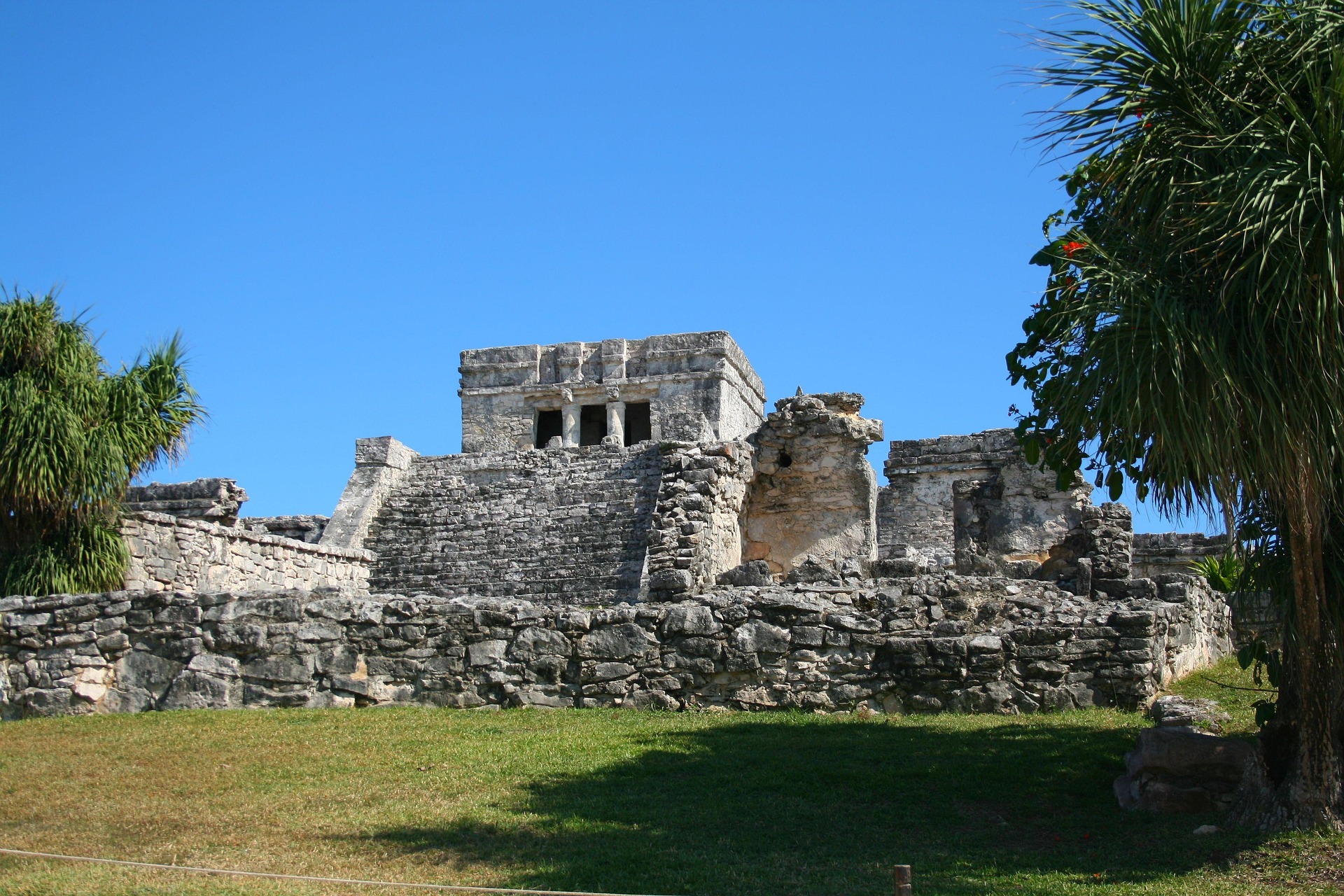
We visited a Mayan ruin site in the middle of the day, and the heat combined with the open stone structures made the place feel almost timeless.
By the end of the Yucatán drive, what stood out most was the contrast between the quiet inland roads and the bright, intense Caribbean coast that kept reappearing along the route.
Best time to visit
The best time to explore the Mexico Yucatán Peninsula Epic Coastal & Mayan Ruins Road Trip Experience is typically during spring and summer months, when weather conditions are stable and visibility is high. However, autumn offers fewer crowds and more dramatic scenery.
Travel tips
- Monitor hurricane forecasts in autumn
- Expect high heat and humidity in summer
- Plan fuel and water stops in rural areas
Why visit
- Scenic landscapes unique to Yucatán Peninsula
- Popular road trip destination in Mexico
- Great for photography
- Varied terrain and driving conditions
Driving Interpretation Layer
What this route means
How long is this route?
The route is approximately 1170.2 km long, with an elevation gain of 112 m.
How difficult is the drive?
This route is classified as Easy, with a maximum gradient of 0.1%.
What kind of terrain does it have?
This is a relatively mild scenic route with steady and predictable driving conditions.
What makes this route unique?
The route combines elevation variation (112 m total gain) with changing landscapes shaped by natural geography and road conditions.
What type of driver is this route best suited for?
This route is suitable for most drivers, including casual travelers looking for a scenic and relaxed drive.
Discovery Layer
More routes in Mexico
About Mexico →More similar scenic routes
Baja California Desert Coastal Scenic Road Trip
Desert coastline road along Pacific Ocean.

Pacific Coast Highway Coastal Scenic Drive
Iconic coastal drive along California's Pacific coastline.
Great Ocean Scenic Coastal Drive
Coastal road famous for Twelve Apostles rock formations.
Garden Route Scenic Coastal Drive
Coastal drive through forests, lagoons and beaches.
Extended Garden Route Scenic Drive
Extended coastal drive with beaches and forests.
Sardinia Coastal Scenic Drive
Turquoise waters and winding coastal roads of Sardinia.