
Route Identity
Bali Volcano Scenic Mountain Drive
Indonesia — Bali
Overview Layer
Overview
The Bali Volcano Route is one of the most scenic drives in Bali, combining volcanic landscapes, rice terraces, and traditional villages. The route offers changing views of Mount Batur and the island's tropical interior, making it a popular road trip for visitors seeking both nature and local culture.
Weather
Tropical monsoon highland climate with distinct wet and dry seasons and strong rainfall variation by elevation.
Seasonal Driving Conditions
Warm tropical conditions with moderate rainfall and improving visibility in upland areas.
- moderate rainfall in uplands
- stable volcanic visibility between showers
Dry season with stable weather and clear visibility around volcanic regions.
- dry roads and stable conditions
- clear mountain visibility
Increasing humidity with gradual transition toward wetter conditions.
- increasing humidity levels
- occasional heavy showers
Wet monsoon season with frequent rainfall and reduced visibility in mountain zones.
- monsoon rains dominate
- reduced traction on mountain roads
Road conditions
Mountain and rural paved roads with steep gradients, sharp curves, and variable traction during wet season.
Driving difficulty explained
Moderate difficulty due to steep volcanic terrain and seasonal rainfall impact.
Route Snapshot Layer
Route Snapshot
This is a scenic driving route in Bali, Indonesia.
The route features moderate driving conditions.
It is classified as Hard and is best suited for general road trip travelers.
Points of Interest
Scenic viewpoints
- alas harum — 82 m from route (5.4 km from start)
- Mount Batur Viewpoint — 15 m from route (38.6 km from start)
Attractions along the route
- Entrance to rice terraces — 20 m from route (5.8 km from start)
- Вулкан Батур — 53 m from route (27.3 km from start)
- I love bas love swing — 28 m from route (49.3 km from start)
- Monkey Feeding Place — 108 m from route (84.0 km from start)
- Prianka Ubud art market — 98 m from route (85.5 km from start)
Actual Driving Track (GPX-data)
Download GPXGPS Data Layer
Measured Driving Route
This route is analyzed directly from GPX track data. It features a total distance of 88.4 km, with an elevation gain of 2099 m.
Route Structure
| Type | Distance (km) | Elevation Gain (m) | Avg Gradient (%) |
|---|---|---|---|
| climb | 35.17 km | 1566 m | 4% |
| descent | 31.29 km | 96 m | -4.4% |
| flat | 21.97 km | 437 m | -0.2% |
About this route
The Bali Volcano Scenic Mountain Drive is one of the most scenic driving experiences in Indonesia. Located in Bali, this route offers a unique combination of landscapes, road conditions and natural highlights.
Stretching over 88.4 km, this drive takes approximately 2 hours.
This route is especially popular among travelers looking for road trips.
Travel Experience
We started out in traffic that didn’t really feel like part of the trip yet, more like leaving a busy area than actually going somewhere scenic. It took a while before the road opened up and things started changing.
At one point we pulled over because there was a small space with a few scooters already parked and people looking out over terraces. We didn’t stay long, mostly because it was a bit crowded and the sun was already strong.
There was a long stretch where the road kept weaving between villages and open rice fields. We didn’t talk much, just slowed down occasionally for dogs crossing or trucks squeezing through narrow sections.
We stopped for food in a small roadside warung that didn’t look like much from outside but worked fine for a break. Nothing memorable happened there, just sitting, drinking something cold, and waiting for the heat to ease a bit.
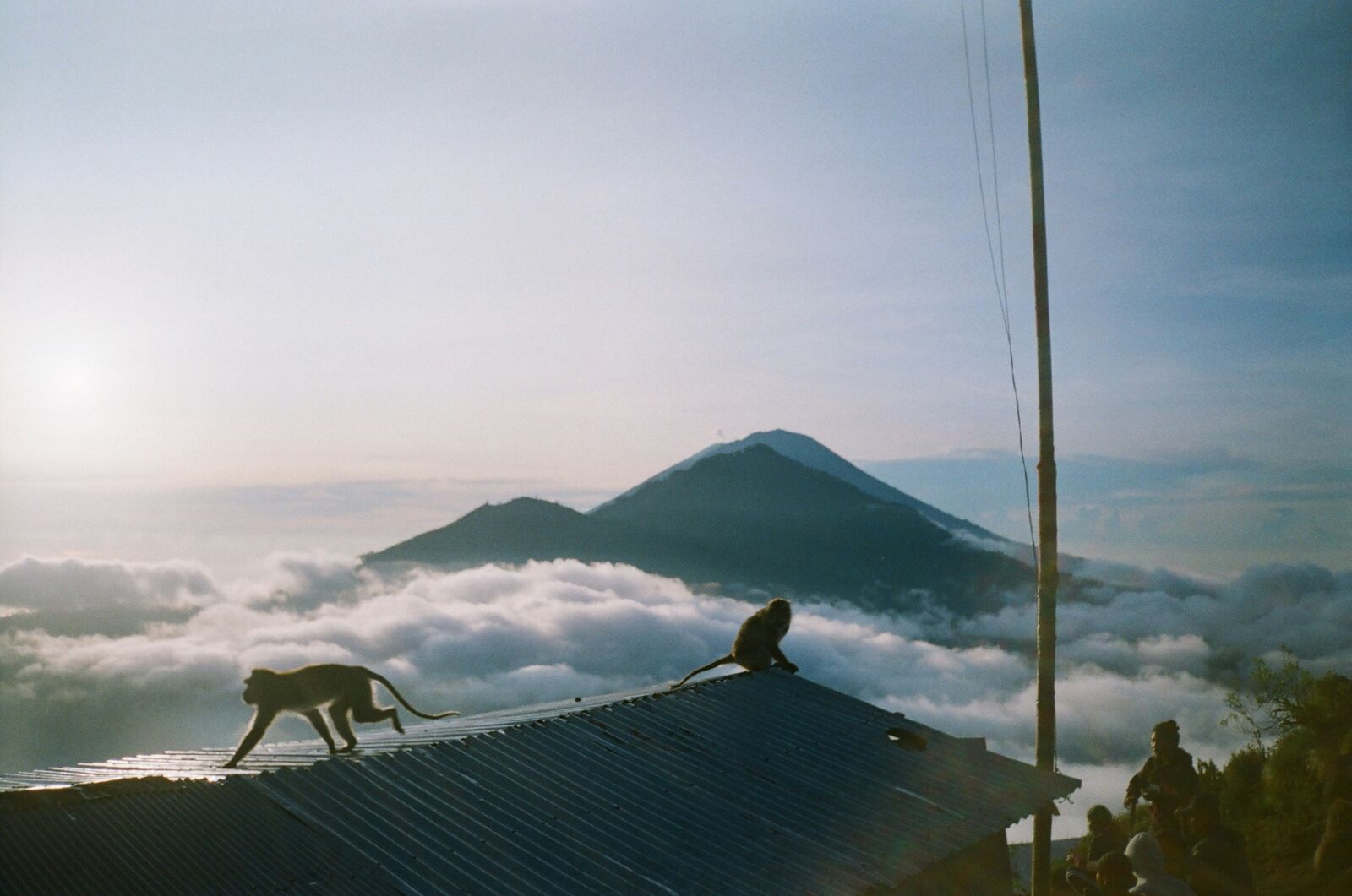
By the end of the Bali Volcano Route, it felt like we were constantly shifting between dense village roads and sudden open views of mountains. The volcano itself never really felt like a single “moment,” more like something always present in the background while everything else passed in front of it.
Best time to visit
The best time to explore the Bali Volcano Scenic Mountain Drive is typically during spring and summer months, when weather conditions are stable and visibility is high. However, autumn offers fewer crowds and more dramatic scenery.
Travel tips
- Avoid travel during heavy monsoon storms
- Use low gear on steep volcanic slopes
- Check road conditions after rainfall
Why visit
- Scenic landscapes unique to Bali
- Popular road trip destination in Indonesia
- Great for photography
- Varied terrain and driving conditions
Driving Interpretation Layer
What this route means
How long is this route?
The route is approximately 88.4 km long, with an elevation gain of 2099 m.
How difficult is the drive?
This route is classified as Hard, with a maximum gradient of 6.7%.
What kind of terrain does it have?
This is a relatively mild scenic route with steady and predictable driving conditions.
What makes this route unique?
The route combines elevation variation (2099 m total gain) with changing landscapes shaped by natural geography and road conditions.
What type of driver is this route best suited for?
This route is suitable for confident drivers who are comfortable with occasional steep sections and mountain terrain.
Discovery Layer
More routes in Indonesia
About Indonesia →More similar scenic routes
Java Volcano & Cultural Epic Road Trip – Jakarta to East Java Volcano Corridor Experience
Cross-island road trip through Java’s volcanoes, rice fields, ancient temples and dense cultural landscapes from Jakarta to East Java
North Island Scenic Loop Drive
Volcanoes, beaches and geothermal landscapes.
Iceland Golden Circle & Landmannalaugar Ultimate Scenic Highlands Route
Epic Iceland road trip combining Golden Circle highlights with the volcanic highlands of Landmannalaugar