
Route Identity
Lake Balaton Scenic Loop Drive
Hungary — Transdanubia
Overview Layer
Overview
The Lake Balaton Loop is a classic Hungarian road trip around Central Europe’s largest lake, passing beaches, vineyards, and small lakeside towns. The route offers a mix of summer leisure atmosphere and slow scenic driving close to the shoreline.
Weather
Continental lake climate with hot summers, cold winters, and moderate seasonal rainfall influenced by the Balaton basin.
Seasonal Driving Conditions
Mild temperatures with moderate rainfall and gradual warming around the lake basin.
- moderate rainfall in basin area
- gradual warming improves road stability
Warm to hot continental conditions with stable weather and high evaporation near the lake.
- dry and stable driving conditions
- high surface temperatures on exposed asphalt
Cooling temperatures with increasing rainfall and occasional lake fog in mornings.
- morning fog near lake surface
- cooling temperatures improve driving comfort
Cold conditions with possible freezing and reduced activity around the lake region.
- cold conditions with possible ice
- reduced roadside activity
Road conditions
Well-maintained paved roads around the lake with gentle terrain and occasional wet surfaces in rainy periods.
Driving difficulty explained
Low difficulty due to flat terrain and well-developed road network.
Route Snapshot Layer
Route Snapshot
This is a scenic driving route in Transdanubia, Hungary.
The route features moderate driving conditions.
It is classified as Moderate and is best suited for general road trip travelers.
Points of Interest
Attractions along the route
- V750VU surface-to-air missile on SZM-63 launcher — 53 m from route (3.4 km from start)
- Üzenj offline — 18 m from route (25.9 km from start)
- Rákóczi-fa — 89 m from route (51.2 km from start)
- Gőzmozdony — 83 m from route (68.1 km from start)
- Tojás — 111 m from route (103.0 km from start)
Scenic viewpoints
- Kilátó — 115 m from route (84.5 km from start)
- Walko-kilátó — 53 m from route (111.9 km from start)
Actual Driving Track (GPX-data)
Download GPXGPS Data Layer
Measured Driving Route
This route is analyzed directly from GPX track data. It features a total distance of 189.3 km, with an elevation gain of 1465 m.
Route Structure
| Type | Distance (km) | Elevation Gain (m) | Avg Gradient (%) |
|---|---|---|---|
| flat | 171.08 km | 1116 m | 0% |
| climb | 10.15 km | 284 m | 2.6% |
| descent | 8.08 km | 65 m | -2.6% |
About this route
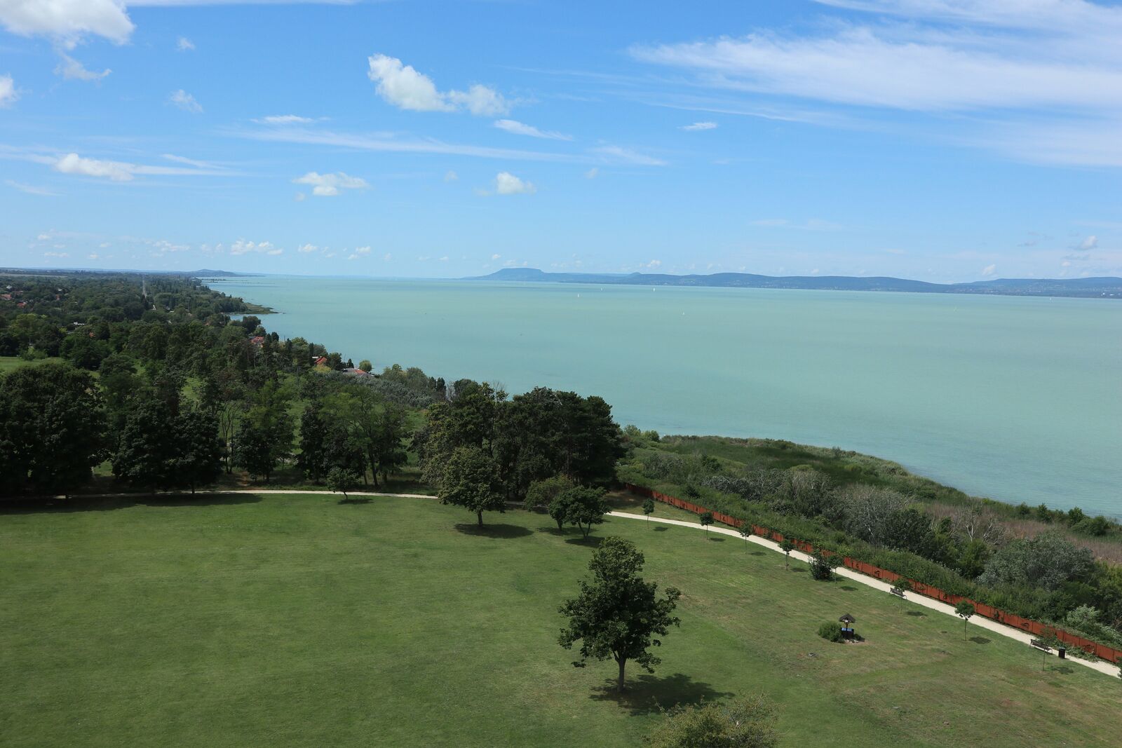
The Lake Balaton Scenic Loop Drive is one of the most scenic driving experiences in Hungary. Located in Transdanubia, this route offers a unique combination of landscapes, road conditions and natural highlights.
Stretching over 189.3 km, this drive takes approximately 4 hours.
This route is especially popular among travelers looking for road trips.
Travel Experience
We started a bit late and immediately hit some light traffic around the first towns near the lake. It didn’t feel like a “scenic loop” right away, more just normal driving past houses and small shops.
At one lakeside stop there were already a lot of people parked, mostly families with towels and food bags. We got out for a bit but didn’t stay long because it was quite busy and finding space near the water felt a bit awkward.
There were stretches where the road stayed close to the shoreline and then drifted slightly inland through vineyards and small settlements. We didn’t really talk much, just occasionally pointing out sailboats or crowded beaches.
We stopped for food in a small town café that felt very seasonal, like it probably changes completely depending on the month. Service was relaxed, and we ended up sitting longer than planned just because it was easier than moving again in the heat.
By the end of the Lake Balaton Loop, it felt less like a single lake drive and more like a chain of short summer stops connected by stretches of slow road. The lake was always nearby, but we experienced it mostly in passing rather than as one continuous view.
Best time to visit
The best time to explore the Lake Balaton Scenic Loop Drive is typically during spring and summer months, when weather conditions are stable and visibility is high. However, autumn offers fewer crowds and more dramatic scenery.
Travel tips
- Watch for morning fog near the lake
- Stay hydrated during hot summer driving
- Check for icy patches in winter mornings
Why visit
- Scenic landscapes unique to Transdanubia
- Popular road trip destination in Hungary
- Great for photography
- Varied terrain and driving conditions
Driving Interpretation Layer
What this route means
How long is this route?
The route is approximately 189.3 km long, with an elevation gain of 1465 m.
How difficult is the drive?
This route is classified as Moderate, with a maximum gradient of 3.0%.
What kind of terrain does it have?
This is a relatively mild scenic route with steady and predictable driving conditions.
What makes this route unique?
The route combines elevation variation (1465 m total gain) with changing landscapes shaped by natural geography and road conditions.
What type of driver is this route best suited for?
This route is suitable for most drivers, including casual travelers looking for a scenic and relaxed drive.
Discovery Layer
More routes in Hungary
About Hungary →More similar scenic routes
Lake Bled Scenic Loop Drive
Scenic alpine lake loop with castle views.
Bükk & Mátra Mountain Scenic Drive – Hungary’s Forested Highlands and Volcanic Peaks
Scenic drive through Hungary’s highest mountains, combining forested Bükk landscapes with volcanic Mátra peaks