
Route Identity
Georgian Military Highway Caucasus Scenic Drive
Georgia — Caucasus
Overview Layer
Overview
Explore the historic Georgian Military Highway through the majestic Caucasus Mountains. This stunning scenic drive offers a cultural road trip experience, combining rugged mountain passes with beautiful Georgian villages.
Weather
High mountain continental climate with strong seasonal variation, snowfall in winter, and rapid weather changes in alpine zones.
Seasonal Driving Conditions
Snowmelt period in higher elevations with potential rockfall and variable road conditions.
- snowmelt affecting slope stability
- rockfall risk in mountain sections
Main open season with generally stable access across the pass and moderate temperatures.
- full route accessibility
- stable pavement conditions in main sections
Cooling conditions with increasing precipitation and early snowfall risk at altitude.
- increasing precipitation
- early frost at higher elevations
Frequent snow and ice conditions with periodic closures of high mountain sections.
- snow-covered road segments
- temporary closures due to weather
Road conditions
Mountain highway with steep gradients, tunnels, and switchbacks. Exposure to snow, ice, and rockfall in higher elevations.
Driving difficulty explained
Moderate to high difficulty due to altitude, weather variability, and steep terrain.
Route Snapshot Layer
Route Snapshot
This is a scenic driving route in Caucasus, Georgia.
The route features moderate driving conditions.
It is classified as Extreme and is best suited for general road trip travelers.
Points of Interest
Scenic viewpoints
- გუდაურის პანორამული გადასახედი — 67 m from route (52.6 km from start)
Places to eat
- ჯოფრე — 0 m from route (247.1 km from start)
Actual Driving Track (GPX-data)
Download GPXGPS Data Layer
Measured Driving Route
This route is analyzed directly from GPX track data. It features a total distance of 247.1 km, with an elevation gain of 3491 m.
Route Structure
| Type | Distance (km) | Elevation Gain (m) | Avg Gradient (%) |
|---|---|---|---|
| descent | 54.25 km | 98 m | -4.7% |
| flat | 142.64 km | 954 m | -0.3% |
| climb | 50.17 km | 2440 m | 4.8% |
About this route
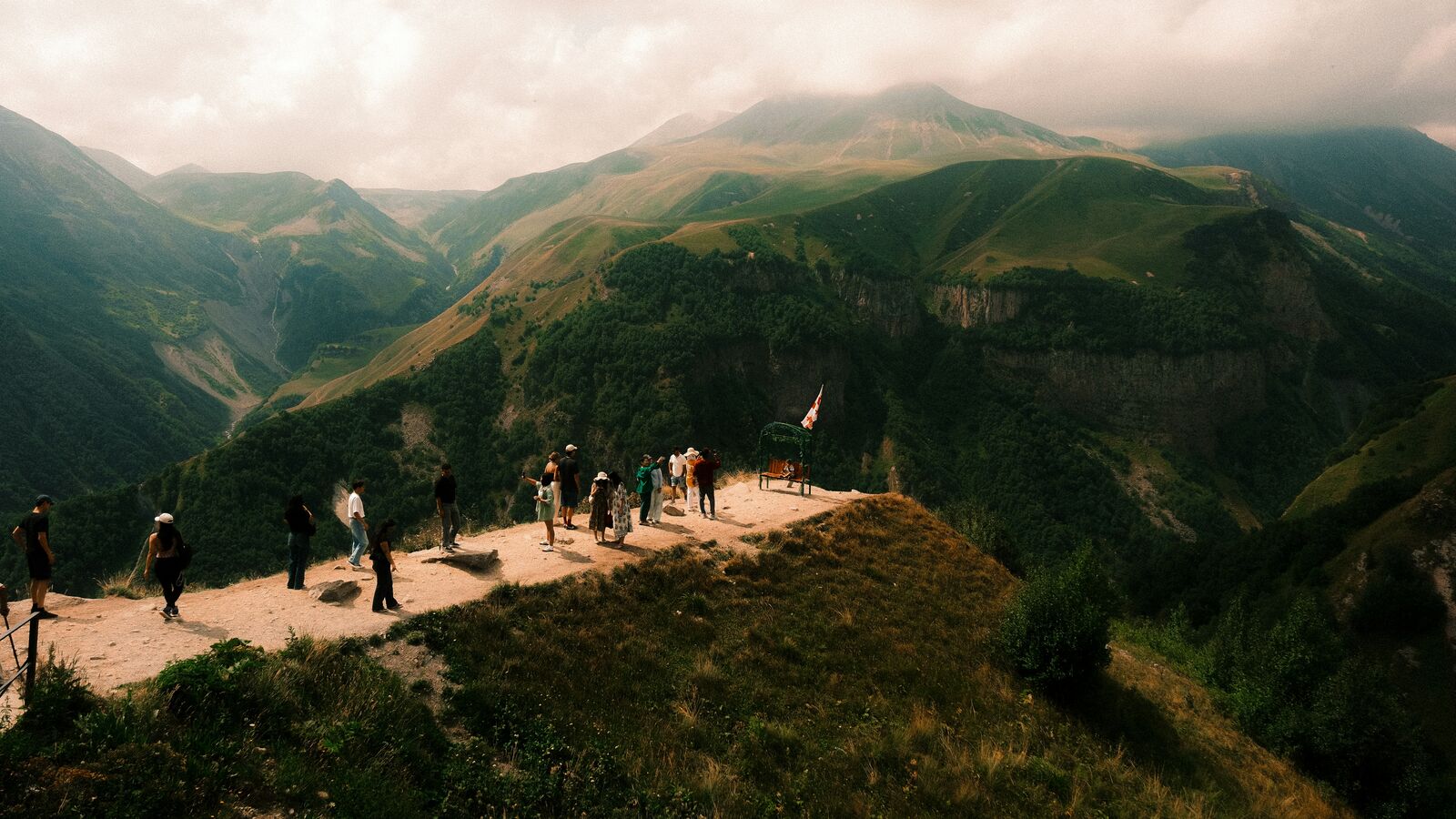
The Georgian Military Highway Caucasus Scenic Drive is one of the most scenic driving experiences in Georgia. Located in Caucasus, this route offers a unique combination of landscapes, road conditions and natural highlights.
Stretching over 247.1 km, this drive takes approximately 5 hours.
This route is especially popular among travelers looking for road trips.
Travel Experience
We left earlier than planned and still somehow ended up behind slower traffic almost immediately. The road started climbing fast and I remember thinking it didn’t really give you time to adjust before the scenery changed.
At one stop there were already a bunch of cars parked and people were just standing around looking at the mountains. We got out, took a few photos, then got back in because it was colder than it looked from inside the car.
There was a section where the road felt busy with trucks and minibuses and we didn’t really talk much. Just lots of stopping and starting, and a bit of waiting behind corners where visibility dropped.
We stopped for food in a roadside place that felt slightly improvised, like it wasn’t fully meant for tourists but still worked fine. The tea took a while and nobody minded, we just sat there watching the road.
I remember at some point someone asked if we were already near the highest part of the Georgian Military Highway, but we never really figured it out. We just kept driving through the Caucasus and assumed we were somewhere close enough.
Best time to visit
The best time to explore the Georgian Military Highway Caucasus Scenic Drive is typically during spring and summer months, when weather conditions are stable and visibility is high. However, autumn offers fewer crowds and more dramatic scenery.
Travel tips
- Check weather conditions before crossing mountain passes
- Expect rapid changes in visibility
- Monitor potential avalanche or rockfall warnings
Why visit
- Scenic landscapes unique to Caucasus
- Popular road trip destination in Georgia
- Great for photography
- Varied terrain and driving conditions
Driving Interpretation Layer
What this route means
How long is this route?
The route is approximately 247.1 km long, with an elevation gain of 3491 m.
How difficult is the drive?
This route is classified as Extreme, with a maximum gradient of 9.2%.
What kind of terrain does it have?
This is a high alpine mountain route with significant elevation changes and exposed terrain.
What makes this route unique?
The route combines elevation variation (3491 m total gain) with changing landscapes shaped by natural geography and road conditions.
What type of driver is this route best suited for?
This route is best suited for experienced drivers comfortable with steep gradients, narrow mountain roads, and changing weather conditions.
More similar scenic routes
Shamakhi to Lahij Epic Caucasus Mountain Scenic Drive – Hidden Valley Road Experience
Short but steep mountain drive through the Caucasus linking Shamakhi with the historic village of Lahij

Route des Grandes Alpes Alpine Scenic Road Trip
High alpine route crossing multiple mountain passes.

Icefields Parkway Rocky Mountain Scenic Drive
One of the most scenic drives in the Canadian Rockies.

Blue Ridge Parkway Scenic Mountain Drive
Scenic mountain drive through the Appalachian Highlands.
Drakensberg Sani Pass Scenic Scenic Mountain Drive (Sani Pass → Lesotho entry)
Mountain drive along dramatic escarpments.
Great Alpine Scenic Mountain Drive
Mountain road crossing Australian Alps.