
Route Identity
Colombian Coffee Region Scenic Drive
Colombia — Eje Cafetero
Overview Layer
Overview
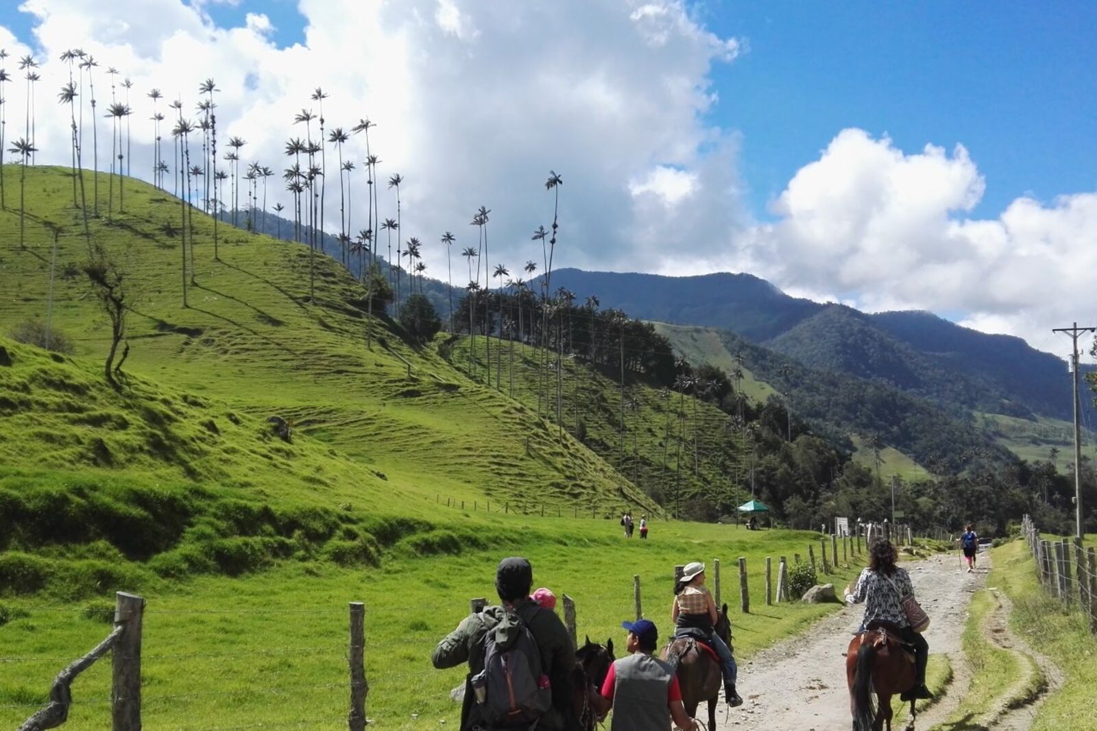
Take a relaxing drive through Colombia's lush Coffee Region. This scenic road trip winds through rolling green hills and beautiful coffee plantations, offering a perfect blend of tropical nature and relaxed Colombian countryside vibes.
Weather
Tropical highland climate with consistent temperatures year-round and strong rainfall variability depending on elevation.
Seasonal Driving Conditions
Mild temperatures with frequent rainfall and active wet season conditions in mountain zones.
- high rainfall frequency in highlands
- reduced visibility in valleys
Variable conditions with alternating dry periods and short heavy rain events.
- mixed dry and wet road segments
- stable temperatures at elevation
Transition toward wetter conditions with increased precipitation in highland areas.
- increasing soil saturation risk
- fog in elevated coffee zones
Relatively drier phase in some zones, though localized rain remains common in mountains.
- relatively reduced rainfall periods
- stable daytime driving conditions
Road conditions
Mountain roads with asphalt and occasional unpaved sections; landslide risk increases during heavy rainfall periods.
Driving difficulty explained
Moderate difficulty due to steep terrain, weather variability, and potential landslide risk.
Route Snapshot Layer
Route Snapshot
This is a scenic driving route in Eje Cafetero, Colombia.
The route features moderate driving conditions.
It is classified as Hard and is best suited for general road trip travelers.
Points of Interest
Scenic viewpoints
- Alto De La Cruz — 3 m from route (66.7 km from start)
- Mirador del tiempo detenido — 14 m from route (89.3 km from start)
Places to eat
- El Portal del Mirador — 4 m from route (66.3 km from start)
- EL BALCÓN DE LOS RECUERDOS — 7 m from route (67.8 km from start)
- El buen gusto — 8 m from route (68.9 km from start)
- Balcones — 2 m from route (88.8 km from start)
- Guanapalo — 9 m from route (106.7 km from start)
Actual Driving Track (GPX-data)
Download GPXGPS Data Layer
Measured Driving Route
This route is analyzed directly from GPX track data. It features a total distance of 119.7 km, with an elevation gain of 2640 m.
Route Structure
| Type | Distance (km) | Elevation Gain (m) | Avg Gradient (%) |
|---|---|---|---|
| flat | 27.78 km | 403 m | -0.2% |
| descent | 45.08 km | 206 m | -3.9% |
| climb | 46.89 km | 2031 m | 4% |
About this route
The Colombian Coffee Region Scenic Drive is one of the most scenic driving experiences in Colombia. Located in Eje Cafetero, this route offers a unique combination of landscapes, road conditions and natural highlights.
Stretching over 119.7 km, this drive takes approximately 3 hours.
This route is especially popular among travelers looking for road trips.
Travel Experience
We started out in decent weather, but it shifted a couple of times during the drive and made us keep adjusting the windows. Nothing dramatic, just one of those humid, slightly unpredictable days.
At one point we stopped near a small café that looked like it was attached to a plantation. We didn’t really plan it, just saw a few cars parked and followed. The coffee was good, but the wait was longer than expected.
There was a stretch of road where the hills just kept rolling one after another. We talked a bit at first, then mostly just sat quietly and watched the green go by. It didn’t feel like there was much need to comment on anything.
We pulled over once for a view that someone in the car insisted was one of the best viewpoints along the road. It was nice, but also kind of similar to the last few we’d passed, just slightly different angles of the same landscape.
By the end of the Colombian Coffee Region Drive, I remember more the rhythm of stopping and starting than any single moment. It was mostly short pauses, coffee, and then more green hills repeating in the background.
Best time to visit
The best time to explore the Colombian Coffee Region Scenic Drive is typically during spring and summer months, when weather conditions are stable and visibility is high. However, autumn offers fewer crowds and more dramatic scenery.
Travel tips
- Monitor rainfall forecasts before mountain segments
- Expect slow travel on steep winding roads
- Fuel availability can be limited in rural zones
Why visit
- Scenic landscapes unique to Eje Cafetero
- Popular road trip destination in Colombia
- Great for photography
- Varied terrain and driving conditions
Driving Interpretation Layer
What this route means
How long is this route?
The route is approximately 119.7 km long, with an elevation gain of 2640 m.
How difficult is the drive?
This route is classified as Hard, with a maximum gradient of 7.7%.
What kind of terrain does it have?
This is a high alpine mountain route with significant elevation changes and exposed terrain.
What makes this route unique?
The route combines elevation variation (2640 m total gain) with changing landscapes shaped by natural geography and road conditions.
What type of driver is this route best suited for?
This route is best suited for experienced drivers comfortable with steep gradients, narrow mountain roads, and changing weather conditions.
Discovery Layer
More routes in Colombia
About Colombia →More similar scenic routes
Cameron Highlands Scenic Mountain Drive
Tea plantations and cool mountain air.
Colombia Medellín, Guatapé, Santa Fe de Antioquia & Jardín Epic Scenic Mountain & Coffee Region Drive Experience
Diverse Colombian road trip through Medellín, Guatapé rock, colonial towns and lush coffee-region mountains