Route Identity
Cappadocia Scenic Valley Drive
Turkey — Cappadocia
Overview Layer
Overview
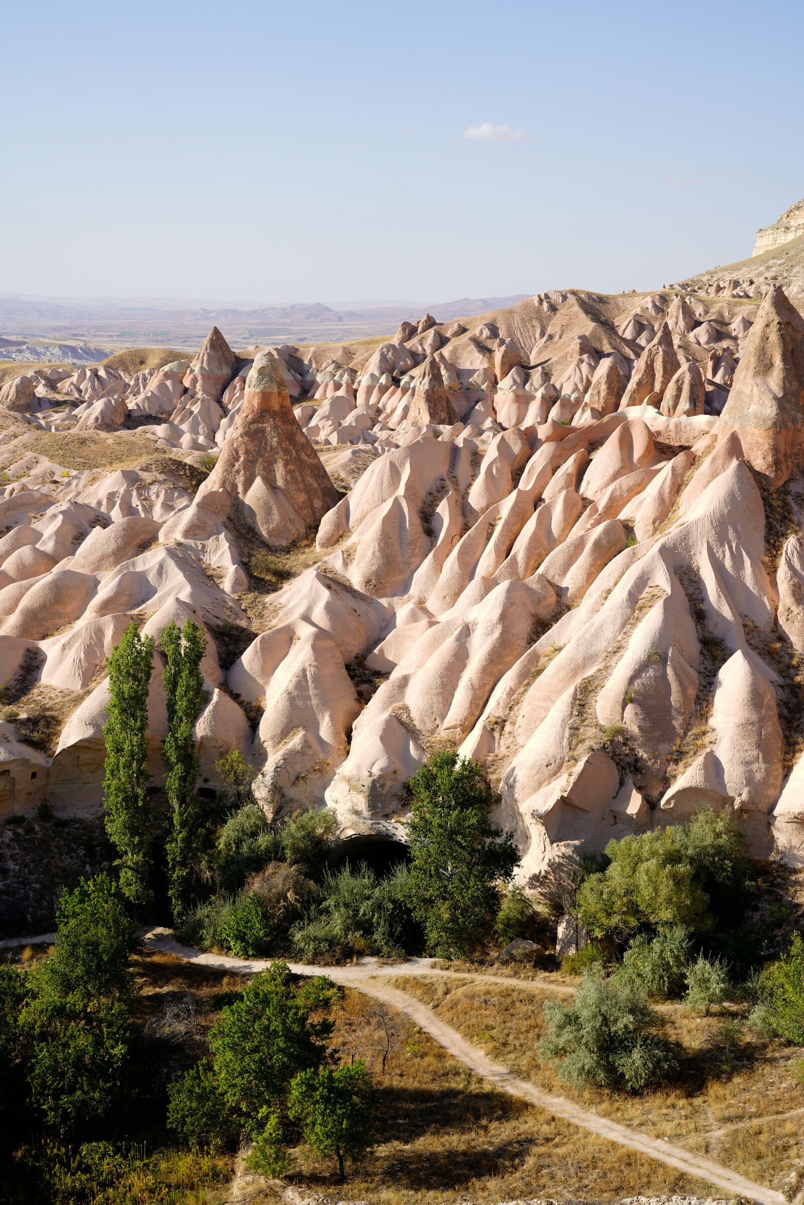
Journey through the spectacular Cappadocia Scenic Drive in Turkey. This easy and mesmerizing road trip showcases unique fairy chimneys, dramatic rock formations, and lush valleys in the heart of Anatolia.
Weather
Semi-arid central Anatolian climate with hot dry summers, cold winters, and low to moderate precipitation across volcanic terrain.
Seasonal Driving Conditions
Mild continental conditions with variable rainfall and moderate temperatures in volcanic terrain.
- moderate temperatures across plateau
- occasional rain affecting rural surfaces
Hot and dry conditions with strong daytime heating and stable road surfaces.
- dry road conditions
- high daytime heat on exposed asphalt
Cooling temperatures with reduced precipitation and stable driving conditions.
- stable visibility conditions
- cooling plateau temperatures
Cold conditions with occasional snow, frost, and reduced traction in rural sections.
- frost on rural roads
- reduced traction in shaded areas
Road conditions
Paved and rural roads across volcanic formations with gentle gradients and occasional wind exposure in open plateaus.
Driving difficulty explained
Low to moderate difficulty due to generally good roads but seasonal temperature extremes.
Route Snapshot Layer
Route Snapshot
This is a scenic driving route in Cappadocia, Turkey.
The route features moderate driving conditions.
It is classified as Moderate and is best suited for general road trip travelers.
Points of Interest
Scenic viewpoints
- Temenni Tepe — 81 m from route (4.6 km from start)
- vista panorámica — 19 m from route (30.1 km from start)
- Üç Güzeller — 33 m from route (80.8 km from start)
Attractions along the route
- Devrent Vadisi — 21 m from route (23.4 km from start)
- Great Caves — 92 m from route (54.7 km from start)
Actual Driving Track (GPX-data)
Download GPXGPS Data Layer
Measured Driving Route
This route is analyzed directly from GPX track data. It features a total distance of 90.5 km, with an elevation gain of 1293 m.
Route Structure
| Type | Distance (km) | Elevation Gain (m) | Avg Gradient (%) |
|---|---|---|---|
| flat | 61.33 km | 720 m | -0.1% |
| climb | 15.83 km | 527 m | 3% |
| descent | 13.29 km | 46 m | -2.8% |
About this route
The Cappadocia Scenic Valley Drive is one of the most scenic driving experiences in Turkey. Located in Cappadocia, this route offers a unique combination of landscapes, road conditions and natural highlights.
Stretching over 90.5 km, this drive takes approximately 2 hours.
This route is especially popular among travelers looking for road trips.
Travel Experience
We started pretty early because someone wanted to catch the light in the valleys, but the first part was just normal driving through small towns and not much happening yet.
At one stop there were already a few cars parked near a viewpoint, and people were mostly just standing around waiting for better photos. We stayed a bit, but it got crowded quickly so we didn’t linger.
There was a stretch where the road kept dipping into different valleys and then rising again. We didn’t really talk much, just occasionally pointing out the rock shapes that looked a bit like things we couldn’t quite name properly.
We stopped for tea in a small place carved into the rock, which felt a bit more memorable than the actual drive at that moment. Service was slow, but it didn’t feel like something to rush anyway.
By the end of the Cappadocia Scenic Drive, it felt more like a series of short valley crossings than one continuous experience. Just rock formations, quick stops, and stretches of road where you’re mostly just moving between viewpoints.
Best time to visit
The best time to explore the Cappadocia Scenic Valley Drive is typically during spring and summer months, when weather conditions are stable and visibility is high. However, autumn offers fewer crowds and more dramatic scenery.
Travel tips
- Avoid midday driving in peak summer heat
- Watch for frost in winter mornings
- Expect variable conditions on rural segments
Why visit
- Scenic landscapes unique to Cappadocia
- Popular road trip destination in Turkey
- Great for photography
- Varied terrain and driving conditions
Driving Interpretation Layer
What this route means
How long is this route?
The route is approximately 90.5 km long, with an elevation gain of 1293 m.
How difficult is the drive?
This route is classified as Moderate, with a maximum gradient of 6.0%.
What kind of terrain does it have?
This is a relatively mild scenic route with steady and predictable driving conditions.
What makes this route unique?
The route combines elevation variation (1293 m total gain) with changing landscapes shaped by natural geography and road conditions.
What type of driver is this route best suited for?
This route is suitable for confident drivers who are comfortable with occasional steep sections and mountain terrain.
Discovery Layer